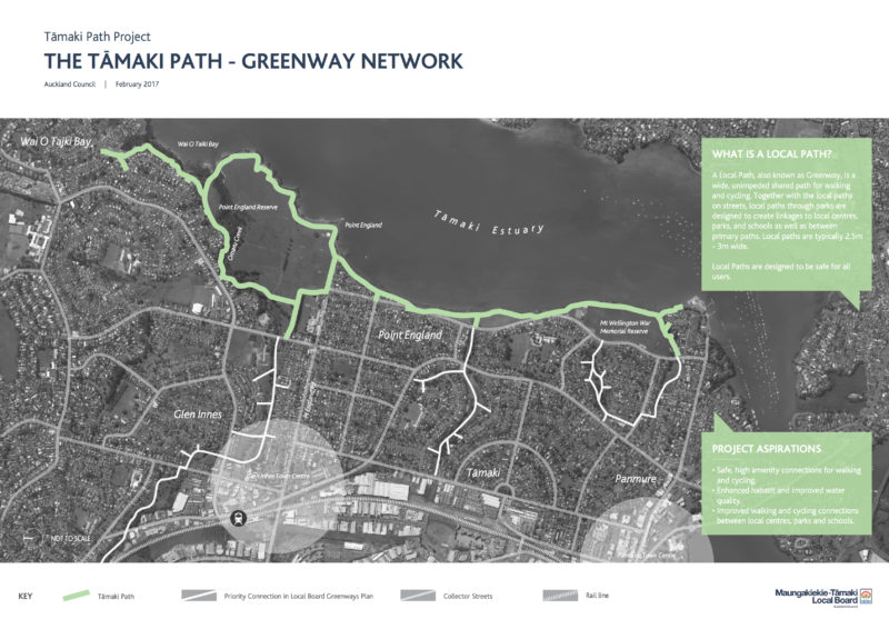
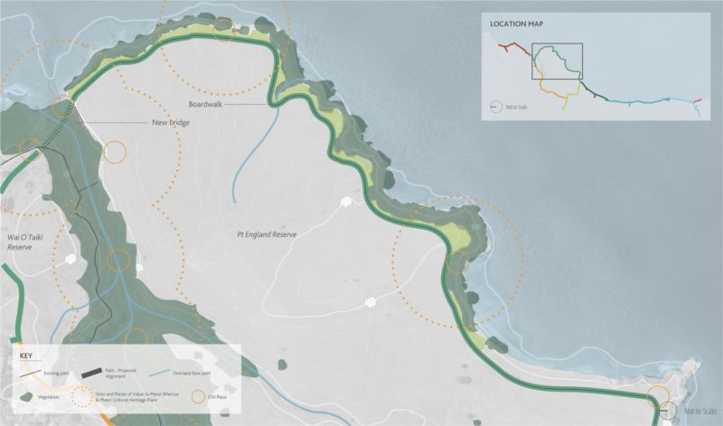
In what might be the first Greenways project out of the gate under the new Local Path Design Guide, consultation is now open on the proposed Tamaki Path, which will run for 5km through the green reserves alongside the Tamaki Estuary, from Wai o Taiki Bay to Panmure Wharf.
This project, which we’ve written about before, has been developed by the Maungakiekie Tamaki Local Board and the Auckland Council Greenways programme.
Feedback has been extended until Thursday 23 February 2017 and here’s the link (scroll down to link for the Online Feedback Form). Note: you can comment on one or all 8 sections of the path.
Our quick take
This is a brilliant vision, and will be a very scenic addition to the options for recreational riding in Auckland. At the moment, there’s limited intent to tie it into the official cycle network – but we’d love to see it set an example and reflect the hopes of the Greenways framework. Above all, we think it’s important to ensure the project meets the very broad strokes laid down in Council’s Greenways Design Guide: 3m wide to allow for shared-path cycling and walking, and no steps. One section in particular doesn’t meet this requirement – see our comments below the maps – but overall we think this is a very promising flagship for the Greenways programme.
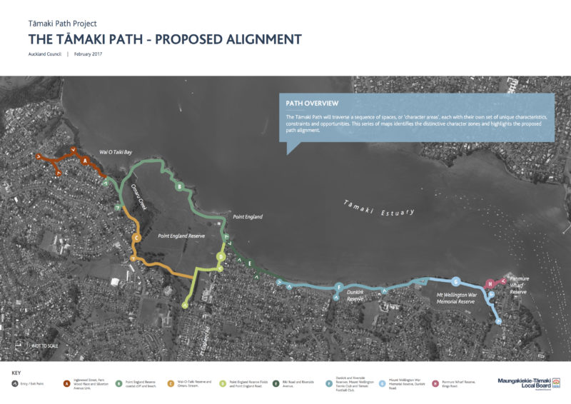
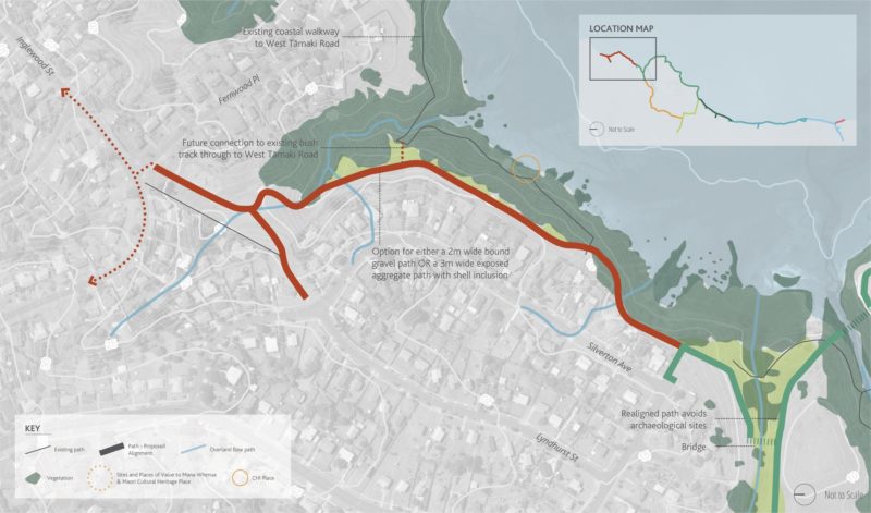
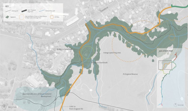
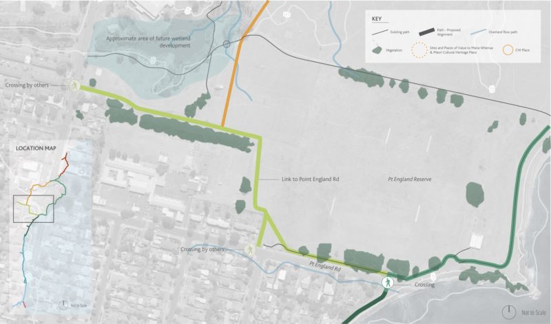
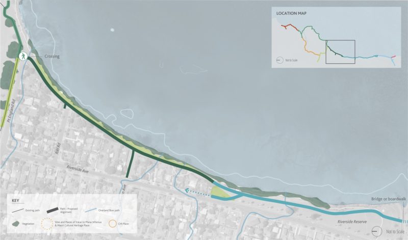
Overview and section maps
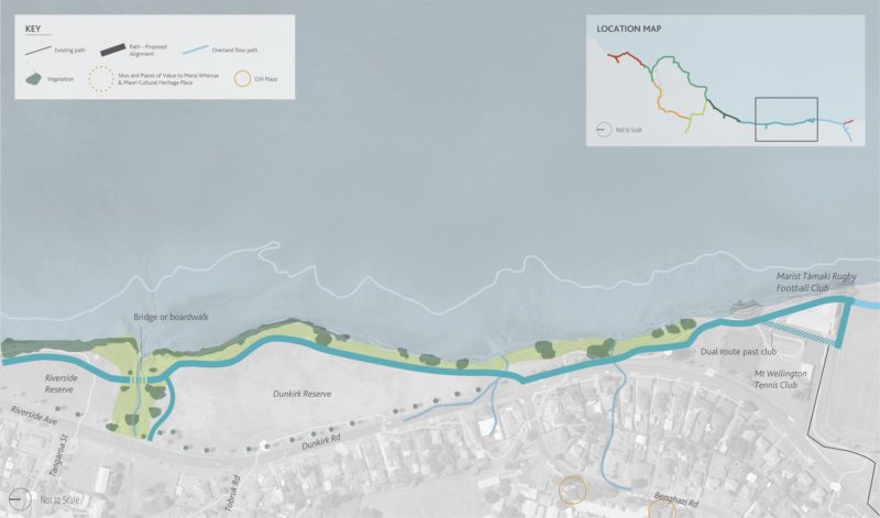
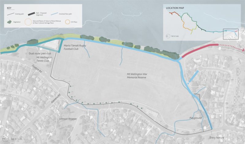

The Omaru Creek section
Section C (through the Point England Reserve) is a very pretty existing narrow gravel path, and the plan suggests it will remain that way – i.e. only 2m wide and compacted gravel – whereas all the other paths in the network are 3m wide and concrete (see, for example, the Riverside Coastal Path, Section E).
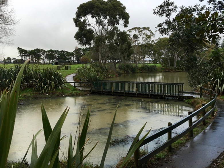
We can see why: as you can see in the photos, the terrain alongside the creek has narrow bridges and steep little hills and steps, so it would be a lot of work to upgrade.
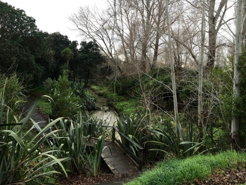
Nonetheless, this is an important part of the path network, and the reality is, people on bikes will use it even if it’s not up to standard. It would be nice if it were fully accessible. After all, as the Local Path definition says:
A Local Path, also known as Greenway, is a wide, unimpeded shared path for walking and cycling… Local Paths are designed to be safe for all users.
Could this section be widened to 3m and smoothed out? We can only ask – and suggest you do, too!
Holistic thinking
This area has been in the news twice recently, for the planned housing development (which has been the subject of some controversy), and also because the Omaru Creek (an important home to native fish and eels) is polluted. We hope Greenways and other developments will mean an upgrade in stormwater treatment for the creek too…. the famous Twin Creeks project in West Auckland sets the standard for holistic treatment of the environment by Council’s Parks department.
Future connections
Links to other paths are out of scope for now, but eventually, it would be fantastic to see this new path connect with:
- Glen Innes to Tamaki Shared Path/ Te Ara ki Uta ki Tai – we hope AT will come to the party and recognise the need for local on-road cycle connections
- The Panmure-Pakuranga Rotary Path, on the other side of the Tamaki River estuary – imagine how cool it would be to go all the way around the foreshore from Point England to Half Moon Bay (quiet roads help this connection, but you’d need to cross the Pakuranga Bridge on the footpath)
- And other water-edge greenways to the south, as envisioned in the Tamaki Trail
Anything else?
We’re keen to hear your thoughts about this project, as always. By all means comment below – or just pop over to the project page to have your say.
Here’s the link again for feedback – scroll down to the link to the Online Feedback Form. Closing date for feedback is Thursday 23 February.

