Good things are happening in Mt Roskill, where years of dedicated advocacy and action just keep bearing fruit. The Puketapapa Local Board under former and current leadership have been exceptional champions for local walking and cycling access, as seen in the links to SH20’s big bikeway and the recent flowering of the spectacular Te Auauanga Restoration Project.
In any network, it’s the little local links that make the difference. And here comes another one, this time to the east – a link from the Roskill School Campus towards Hillsborough Rd.
Consultation is open until Friday 26 July, and we warmly encourage you to add your support!
Here’s the project information page.
And here’s the quick feedback form.
Our speedy suggestions for answering the two feedback questions
Q1. Do you have any issues or suggested changes regarding the specific measures used and/or locations of the measures?
Add your own thoughts here – we recommend you specifically mention:
- Support improving the laneway links, adding the raised Hayr Road crossing and slowing down excessive speeds
- Ask that the footpaths on Hayr Road be widened for at least a short distance – to create a shared path between the laneway entrance, the raised crossing, and Haughey Ave
- Ask that the side build-outs proposed on Haughey Ave are replaced by raised tables or speed bumps (less likely to force riders into conflict with overtaking traffic, more likely to actually slow traffic down) – in particular, ask for a speed table at the entrance to Haughey Ave from Hayr Road
Q2. Do you have any other comments or suggestions on improving walking and cycling connections in Mount Roskill?
Add your own thoughts here – we recommend you specifically mention:
- Kudos to the Local Board for their leadership on local links like these ones!
- Extend the route onward to Hillsborough Road and Monte Cecilia Park in a future project, soon!
So, what’s proposed?
The idea is to improve access to community spaces and facilities and give children safer routes to walk and cycle to school, with improved paths and reduced traffic risk from cars. More planting, safer crossings and some speed calming measures are also in the mix.
This project creates a link between the Mt Roskill School Campus towards Monte Cecilia Park. This extends the Eastern Dominion Rd Safe Route which meets Frost Rd at the northern edge of the Mt Roskill Primary School playing field. The project would be constructed in late 2019.

The project has two key components:
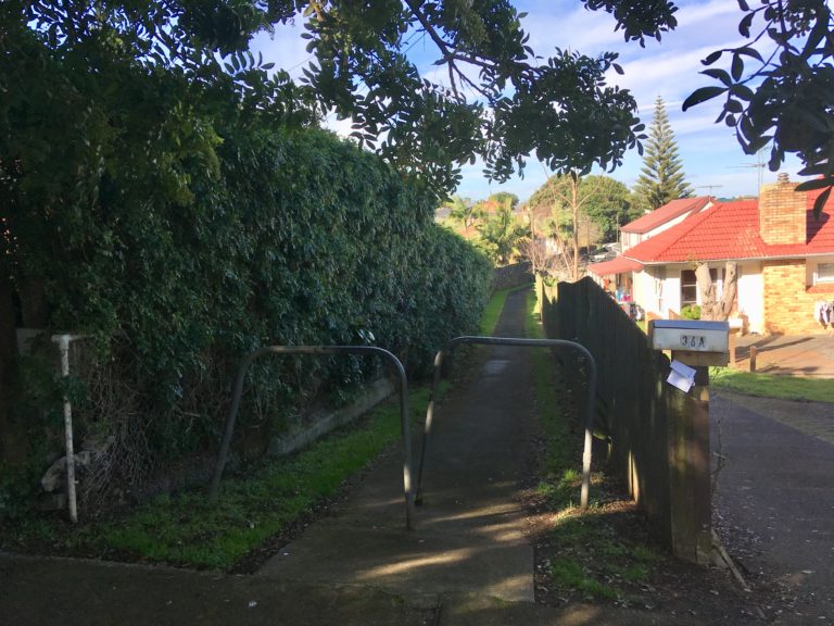
1. Improved laneways (what we used to call alleyways!) between Dornwell Rd/Clinker St and Clinker St/Hayr Rd:
- New 2.8m wide concrete shared paths (2.5m in a few areas where width is limited)
- Installation of bollards at the start and end of each of the laneways to stop cars from driving through
- New street lighting at the start, mid-point, and end of the laneways
- Vegetation/shrubs/hedges trimmed back to the boundary
- New road marking and signage

Compared with the really narrow paths you might find in other places connecting up the little side streets, this isn’t too bad. Of course, if you meet someone coming the other way, slowing down and a friendly nod will be very appreciated! So this part of the proposal gets our tick.
2. Traffic calming on Britton Ave, Dornwell Road, and Haughey Ave, as well as on adjacent sections of Hayr Road
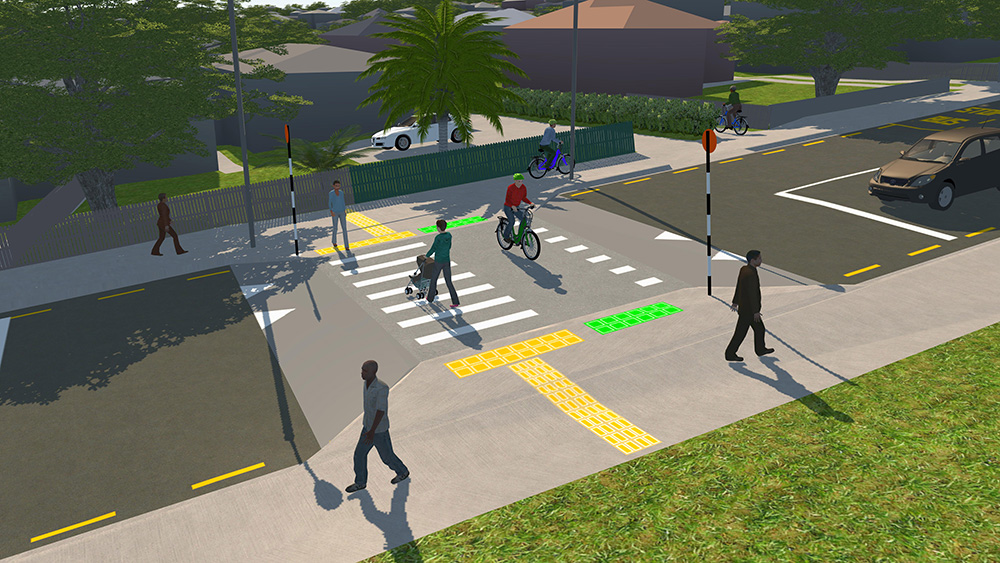
The proposed traffic calming is a mixture of speed bumps, raised tables, and side islands. The works also come with a raised table crossing (with pedestrian AND bike priority, evidently!) across Hayr Road.

The key change we’d like to see here: the footpaths on Hayr Road should be properly widened so you can ride safely between the laneway from Clinker Street and the entry to Haughey Ave without having to squeeze past walkers on narrow footpaths.
We’re also not so keen on the proposed traffic calming on Haughey Ave, which seems to be mostly side buildouts. These can narrow the route for people on bikes at the worst moment. So we’d like to see more use of raised tables instead – for example, at the entry to Haughey Ave just off Hayr Road. This would be a better way to slow down speeding traffic, without adding pinch points for bikes.
Thinking ahead about the next link
The name of the project is a wee bit of a misnomer, as a safe connection to Monte Cecilia Park isn’t included this time round – though the route snakes ever closer. The current project stops where Haughey Ave meets Hillsborough Rd (likely for budgetary reasons). We expect in future the Local Board could continue the link up Hillsborough Rd to Delargey Ave and into the park.
Thinking ahead, our ideal solution for the missing link here would be protected bike lanes on Hillsborough Rd – even a short section to cover the section you’d need to be on the “big road” – and then a safe crossing over the road at Delargey. This should be a raised table crossing with a zebra for bikes and pedestrians, like the one in the AT image above.
This fix would work both for commuter cyclists and the wide variety of ‘interested but concerned’ folk on bikes in Mt Roskill – e.g. parents with children, or people out giving biking around their community a try.
In general, we prefer not to ask for shared paths, as they’re bought at the cost of discouraging walking. That said, a short-term (and more affordable) interim treatment might be a good crossing at Delargey, and 2.5m shared paths alongside Hillsborough Rd, with a grass buffer to the road.
In either case, we warmly encourage the Local Board to work with Auckland Transport and plan ahead to fill this last gap that will be left after the current project. In combination with the nearby SH20 bikeway and the fabulous paths along Oakley Creek/ Te Auaunga, this would create probably the most comprehensive neighbourhood pathway network in the city.
And in the meantime, please support this project – feedback closes Friday 26 July. Here’s the feedback link again!


