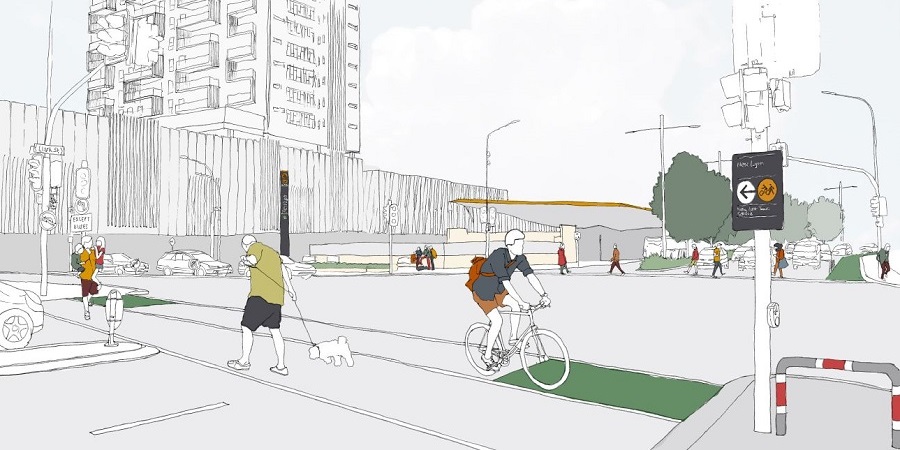
Auckland Transport is looking for feedback on making safer links for walking and cycling in the wider New Lynn area. In particular, says AT: ‘The area has good potential to get more people travelling to train stations by bike. Initially, New Lynn Train Station is our priority as it’s the third busiest station in Auckland, and will only be a 26-minute train ride from the city once the City Rail Link is constructed.’
As with the recent Glen Innes and Inner West consultations (and the current Inner East one), the idea is to gather local intelligence on what routes are important, where the missing links are, and what barriers are getting in the way of traveling by bike.
Feedback is due by Friday 24 June 2016. Here’s the project info page, and once again, you can deliver your feedback in whichever way suits you best:
- via the online form
- by dropping virtual pins on the online map
- or filling in the paper form, arriving in letterboxes and libraries this week.
You can also ask questions online, or at two public events:
- Tuesday 7 June, 3- 7pm – New Lynn Train Station (in the waiting area close to the bike parks)
- Thursday 16 June, 6 – 9pm – New Lynn Night Market at the New Lynn Community Centre, 45 Totara Ave
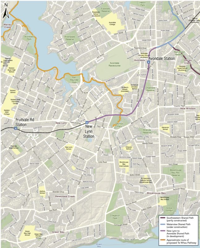
Here’s the area for consultation. It’s a biggie! Click to enlarge even further… and then scroll down for our initial thoughts.
Of course, we strongly support the proposed/ planned cycleways shown on the map: Te Whau Pathway, the New Lynn to Avondale trailside path, the Waterview Shared Path and the Roskill Safe Streets. Not only are these extremely useful links, they’re great for integrating communities and improving safety – more people walking and biking will help activate these spaces. (Plus, the railside path is a safer option for those who currently walk illegally on the train tracks between St George St and Portage Rd.)
Apart from that: we see a blank slate of pure potential.
But where to start? Well, the local roading network is old, and was based on boundaries of farm/quarry/brickworks – and the area was subdivided for housing in an era when town planning allowances didn’t include protecting greenways along streams, etc. All of which poses some challenges. We love challenges.
So we assembled a Westie Bike Brains Trust to help us clarify some of that local potential – cheers to Phil; Sarah, Jess, Callum & Hamish from the Bike Avondale crew; and Braden of Bike Green Bay!
Area-wide
- Greenways and quiet streets are welcome – but bike-safe routes along main arterials should be a priority, too. Sending bike traffic via quieter back roads is one option, but in this area, secondary routes tend to be indirect and therefore unattractive to all but social/recreational riders.
- School students need safe travel – but there are few routes that don’t require use of some of the main commuter-choked roads. For example, Green Bay High and Avondale College are adjacent to busy roads, and there are currently no simple connections from either school to the surrounding suburbs in that 1-5km ‘Goldilocks’ just-right cycling zone.
New Lynn is on the up and up, with the new train station, the Brickworks shopping centre, and a lot of new housing on the way. For those commuting to town, ‘bike and ride’ to the station should be a natural option. What’s needed:
- More secure bike parking at New Lynn Station (especially as there are pragmatic limits on fitting bikes on trains at peak commuter hours).
- Safe routes to the station. Currently, all the main roads in the area are a challenge to ride on, even the cycle lanes on Clark St. Biking to the shops or the library (behind the bus interchange) is scary – not what you want by way of a ‘town centre’ vibe.
- Alternate (but still effective) routes around this car + truck + bus frenzy. Traffic passing through New Lynn feels impatient (perhaps because drivers encounter the highest density of traffic lights in New Zealand – a traffic-calming paradox!). Plus it’s a transport hub, so there are a large number of bus movements in a small area.
- Brickworks and the movie theatres need more bike parking! Good news: they’ve been receptive to feedback on this so far, but friendly encouragement always helps.
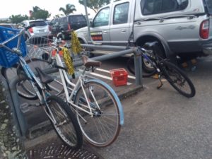
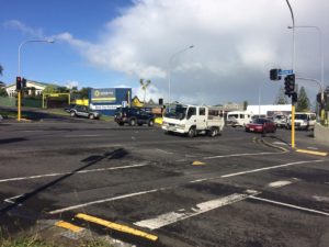
- The Great North Rd /Titirangi Rd corner needs improvement – it is a busy one for sport and commuter riders – and a dangerous intersection, too. Many of the riders using this intersection are traveling on main roads and won’t necessarily shift to the railside path, so…
- Planning should account for existing cycling ‘desire lines’ via Ash and Rata St to/from Waterview and Titirangi and adjacent suburbs.

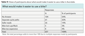
- Bike parking at the Avondale markets: thousands of people go every Sunday, bike travel would cut down on traffic congestion – and there’s a wee ‘Learn to Ride’ playground right next door.
- The new Great North Road bus lane needs enforcement; 1 in 10 cars ignore it.
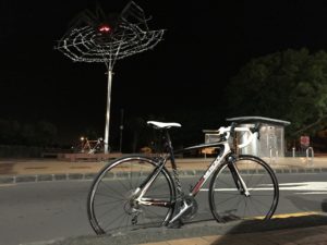
Dale the spider isn’t the scariest thing about Avondale’s main shopping street, if you’re on a bike. - Avondale’s main shopping street needs improvement: it’s currently hostile for cycling, with no marked bike lanes or protected paths, and a scary roundabout. For anyone arriving by train or via the railway path, you’re currently thrown into the wilderness. And there’s a nasty pinch point in the shops where Great North Road meets Rosebank Road.
- Rosebank Rd needs formal bike facilities. It’s well-travelled by commuter cyclists heading to and from the NW cycleway. It has a ‘sort of’ cycle lane on both sides (a painted single line, with yellow dashes to indicate no parking/ no stopping), from Mead St to the motorway. It would be great to see this formalised with markings/paint – or even better, to see the very wide berms/footpaths be repurposed for separated bike lanes.
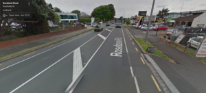
- Safer routes to Avondale’s schools. In particular, Rosebank Road provides access to the intermediate and high schools, as well as to a swathe of residential streets and a bunch of sports facilities. Proper bike facilities here – perhaps with improved alternative links via Victor St – could see a big increase in cycling.
- The Ash St/Rosebank Road intersection needs fixing, as it’s notorious for red light runners and frustrating phasing.
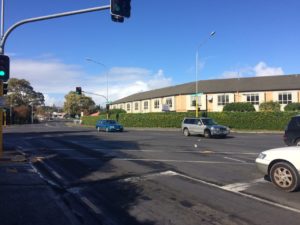
- And Avondalians agree that bike links from Avondale to New Lynn via Ash St are a high-value way to improve cycling through this area, as well as from Kelston into Avondale/ Mt Albert/ Waterview. Alternative routes via Canal St could also be promoted, especially if the Tony Segedin Reserve walkway over the estuary was made bike-friendly. (Rata St already has pretty wide footpaths – could you bike straight from Rata onto Canal perhaps?)
Green Bay is regularly touted as a ‘family hot spot’ – and for good reason! It’s green, friendly with good schools and great natural amenities within reasonable commuting distance to the city. If there was a suburban area primed for utilising safer, easy access cycling infrastructure this would be one. The suburb is fed by two main arterial roads – Golf Rd, which sits on the norther border along the top of a ridge; and Godley Road, which links Craigavon Park, two strings of shops, and the local primary and intermediate/ high schools.
- Better access to New Lynn Station from Green Bay; a shared path/cycle lane along Titirangi Road would provide a good corridor for access to the station.
- Godley Road should be a key priority. The road is currently wide enough for confident adult cyclists to commute on (and many do). However, the east-west direction can get a bit nasty past the New World shops with cars reversing etc.
- Golf Road needs connecting to the Portage Road bike route. Could the Golf Road footpath be widened into a shared path, for example?
- Link the schools to Craigavon Park. Some form of safe cycling infrastructure (lane or shared path) is needed to link the schools (at the Western end of Godley Road) to the shops (at the midway point) through to Craigavon Park (at the eastern end).
- A safe crossing of the Godley Road/ Portage Road/ Connaught Street complex to get to Craigavon Park – this is a hot topic among locals.
- Safe links from Godley Road and the schools to Portage Road would give Green Bay residents great access to Olympic Park/ Whau Pathway/ New Lynn Station.
- Promote Connaught Street/ Gilfillan Street as a safe cycle route between Blockhouse Bay and Green Bay.
And that’s just scratching the surface. As one of our brains trust put it: ‘The good news is there is so much room for improvement that any steps would be a huge, huge benefit.’
Here’s the link to the feedback page again. Go for it! And please do share your thoughts below, to spark further ideas…

