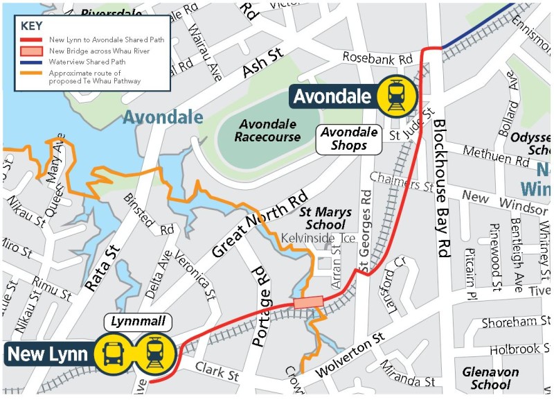
Westward ho – the network expansion continues! Next off the rank from AT is the New Lynn to Avondale shared path, now open for consultation. As you may have already heard, this project is a (pretty major) spin-off from the Waterview Shared Path, as we described here, and is funded from the Urban Cycleway Programme.
The 2.9km project will give us not only a link from New Lynn and Avondale to the Central Isthmus cycleways – but also of course a nice way of travelling between the two suburbs themselves. And for others, it will serve to make the ride to the nearest train station so much easier.
This is, in a way, just the start. Another project for which consultation will follow in a few months will be centred on New Lynn as an area (with consultation extending to Glen Eden and Avondale), and will focus on feeder links and other local cycle improvements. So this is the trunk, the other project will be the branches – and the Te Whau Pathway crossing the route in the middle? Well, that’s a whole other tree growing!
Your feedback is warmly welcomed until 15 May. Here’s the link.
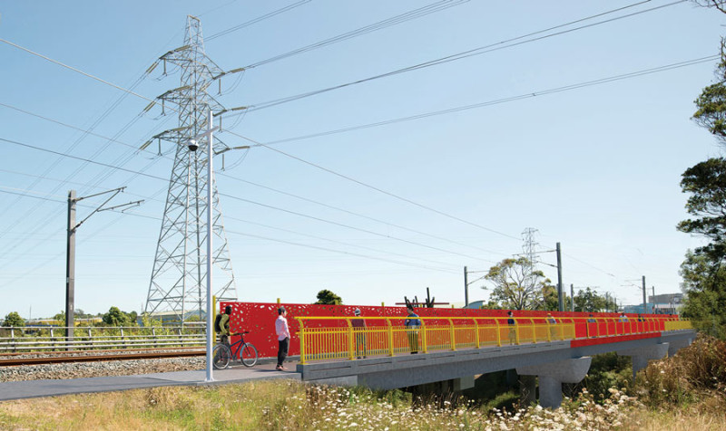
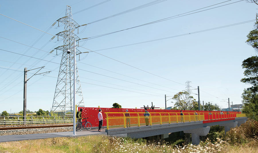
The path includes a new bridge over the river Whau, where it will cross paths with the steadily expanding Te Whau Pathway. Designs for the bridge are currently being consulted on with mana whenua, so the image below is just indicative, with the final colour and features yet to be announced.

We’re looking forward to the final designs, about which AT says:
In the past Maori used the Whau River as a portage route between the Manukau and Waitemata Harbours. Iwi have chosen imagery for the path and the bridge, promoting the importance to the local area of traditional waka portage and harvesting activities along the Whau River and the migration of the kuaka (godwit).
These images will be portrayed in various ways on the bridge and along the path. There will be patterns within the concrete on the bridge structure. In addition, images will be cut out of a metal panel which will run across the bridge, screening it from the adjacent rail bridge.
Exciting! As is the timeline, with the bridge scheduled for construction in late 2016, and the path to follow in 2017. You can have a closer look at the current plans here (and if you want to see everything available, the info brochure is here).
- The path starts at Rankin Avenue in New Lynn and finishes east of the Blockhouse Bay Road/Rosebank Road/Trent Street intersection in Avondale.
- It mostly occupies the rail corridor, and crosses Chalmers Reserve
- Gaps in the existing shared path between Rankin Avenue and Portage Road will be filled with new sections of shared path.
- There’ll be access points at road crossings including Portage Road, Arran Street, St Georges Road, Chalmers Street, St Jude Street and Blockhouse Bay Road.
- Fenced from the railway line and neighboring properties, well-lit and landscaped.
You can see the plans and ask any questions at the AT open house, nicely timed to coincide with the New Lynn Night Market:
When: Thursday 5 May 2016.
Time: 6pm to 9pm.
Where: New Lynn Community Centre, 45 Totara Avenue, New Lynn.
So what aspects do we feel need some further work, or should be supported more strongly?
- At Avondale Train Station, the plans show some slightly worrying signs expecting cyclists to dismount for a short section where the path goes halfway down a mobility ramp (shared with people wanting to access the train station). Now, we’re aware AT worked hard on this section based on our earlier comments to them, and they did a great job (initial designs assumed land purchase from private properties at very high cost and risk of delaying the project). However, expecting cyclists to walk their bike is a very low level of quality for a primary route, and if it doesn’t work, we may one day suddenly see chicanes added as a stop-gap measure. Please ask AT to look at sensible options (no tight chicanes) of slowing down cyclists when passing the ramp at Avondale Train Station, rather than assuming they’ll dismount.
- At the Whau overbridge at Olympic Park, the future Te Whau pathway will extend to the north and south. However, the ‘when’ is unclear in terms of programme and funding, despite Olympic Park in particular being extremely nearby at this point of the route. This project is not building even a short link to the park – which means that people will have to make a substantial detour until at least Portage Road, or may feel tempted (especially when walking) to do dodgy things by way of shortcuts. Please ask AT and Council to prioritise a short link into Olympic Park, if not as part of this project, then as soon as possible afterwards.
- New side connections? Unlike at the Glen Innes-Tamaki Drive path, most sections of this route are accessible via local roads at many more locations – with the single longest gap being the 600m between St Georges Road and Chalmers Road. In coming years, the focus will be more about making those local streets more cycle friendly by adding bikeways or slower speed zones. But if AT (or we) have missed any obvious additions or side access options that would make getting onto the path easier, please mention it in your feedback!
Overall, these are relatively minor quibbles with this path. And some earlier issues where we had input have already been resolved; for example, Bike Auckland and Bike Avondale managed to get a new access to Arran Street included.
Of course the New Lynn end of the route in particular will need a lot more work to become a cycle-friendly area – but this is the first bold stroke, to be followed up soon (as noted above) by a more area-wide assessment and works.
So please add your voice in support of the plan – here’s that link again! Let’s get this network moving!


