It’s time for a fresh look at all the bike infrastructure being delivered across Tāmaki Makaurau Auckland. We report on what’s been built, what’s underway, and what’s glimmering on the horizon – because it’s important to count what we’ve won by raising our collective voices.
Since our last Project Watch round-up in late 2021, we’ve celebrated the opening of high-profile routes linking Glen Innes to (almost) Tāmaki Drive, and New Lynn to Avondale; the new Ngā Hau Māngere bridge, the solving of the Kingsland North Western bottleneck, a dedicated bike path through Mission Bay… and more.
In fact, there’s so much to report that over the coming weeks we’ll be delivering a Project Watch from each part of the region, starting with the central part and working our way around. Stay tuned for updates from your area!
Eyes on the City Centre
Te Wai Horotiu path – completed November 2023
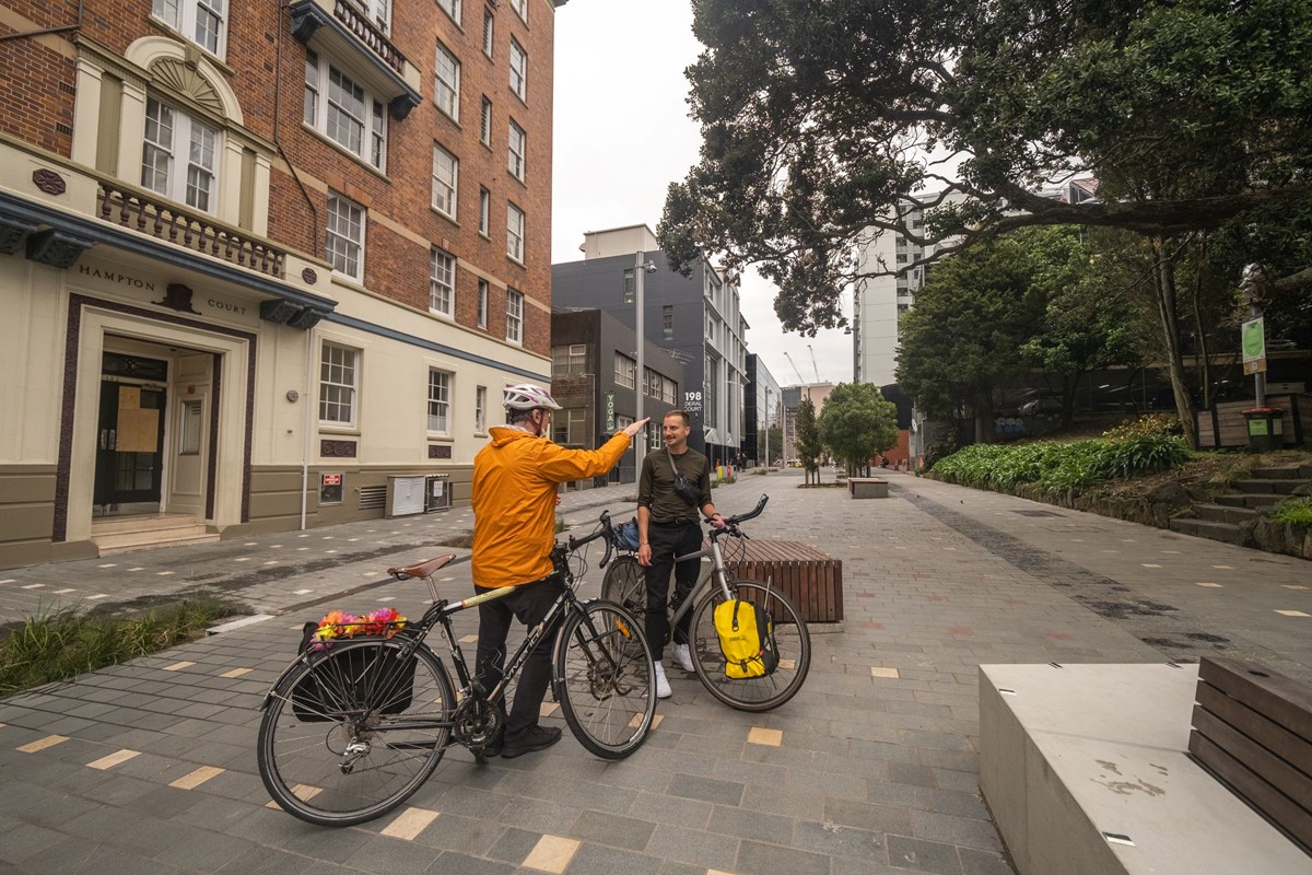
This new paving has now jazzed up the central city and made it safer to travel a major section of Queen St on wheels. The asymmetrical layout, while unusual, helps create an expansive space for people on feet and wheels – and makes the Golden Mile less of a traffic funnel, and more of a delightful ramble.
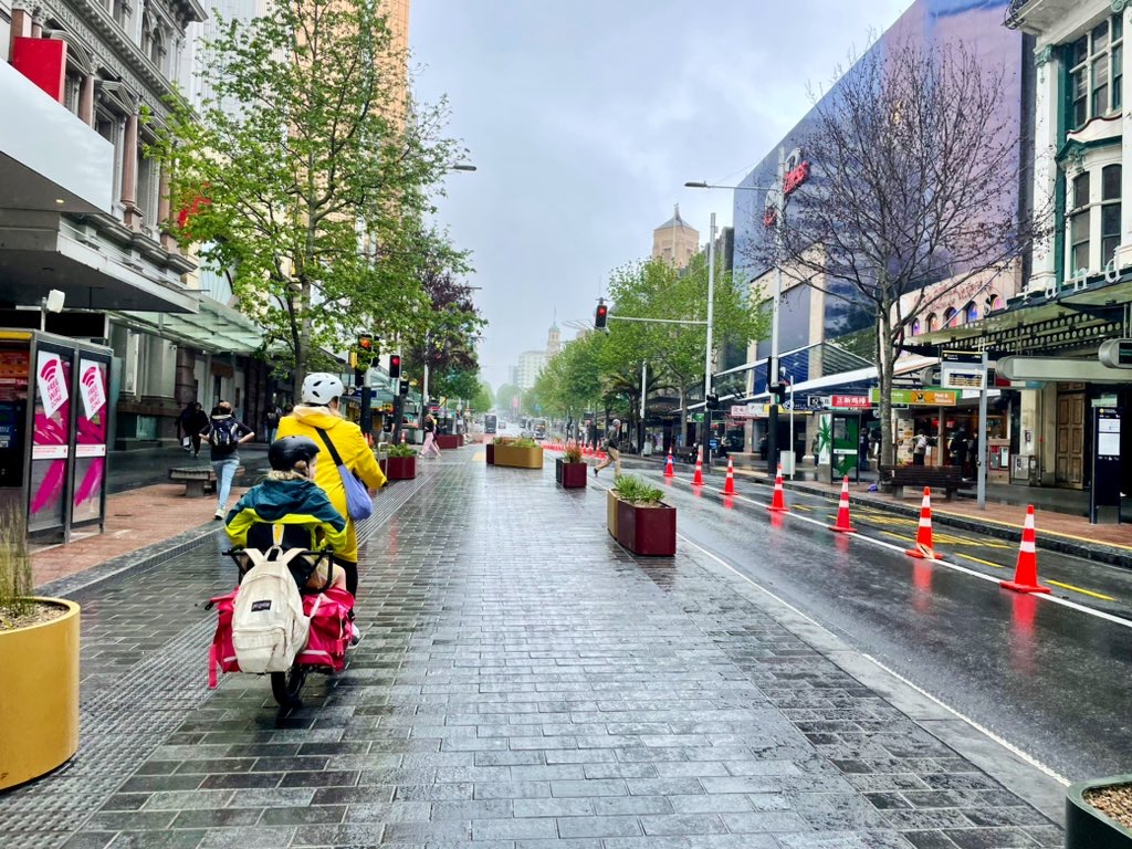
The question remains: when will Council and Auckland Transport “ungap the map” from the Town Hall to Karangahape Road? Logically, there’d be dedicated space the length of the Golden Mile, and we will continue to advance this vision.
In the meantime, Greys Avenue (the location of the city’s first ever bike ride!) offers a smoother slope that almost gets you there – see below for more on current and future connections at each end.
Federal St upgrade – completed mid-2022
This lovely laneway runs from Wellesley St to Mayoral Drive, a handy connection on the west side of Te Wai Horotiu valley.
Waimahara/Myers Park underpass – completed December 2023
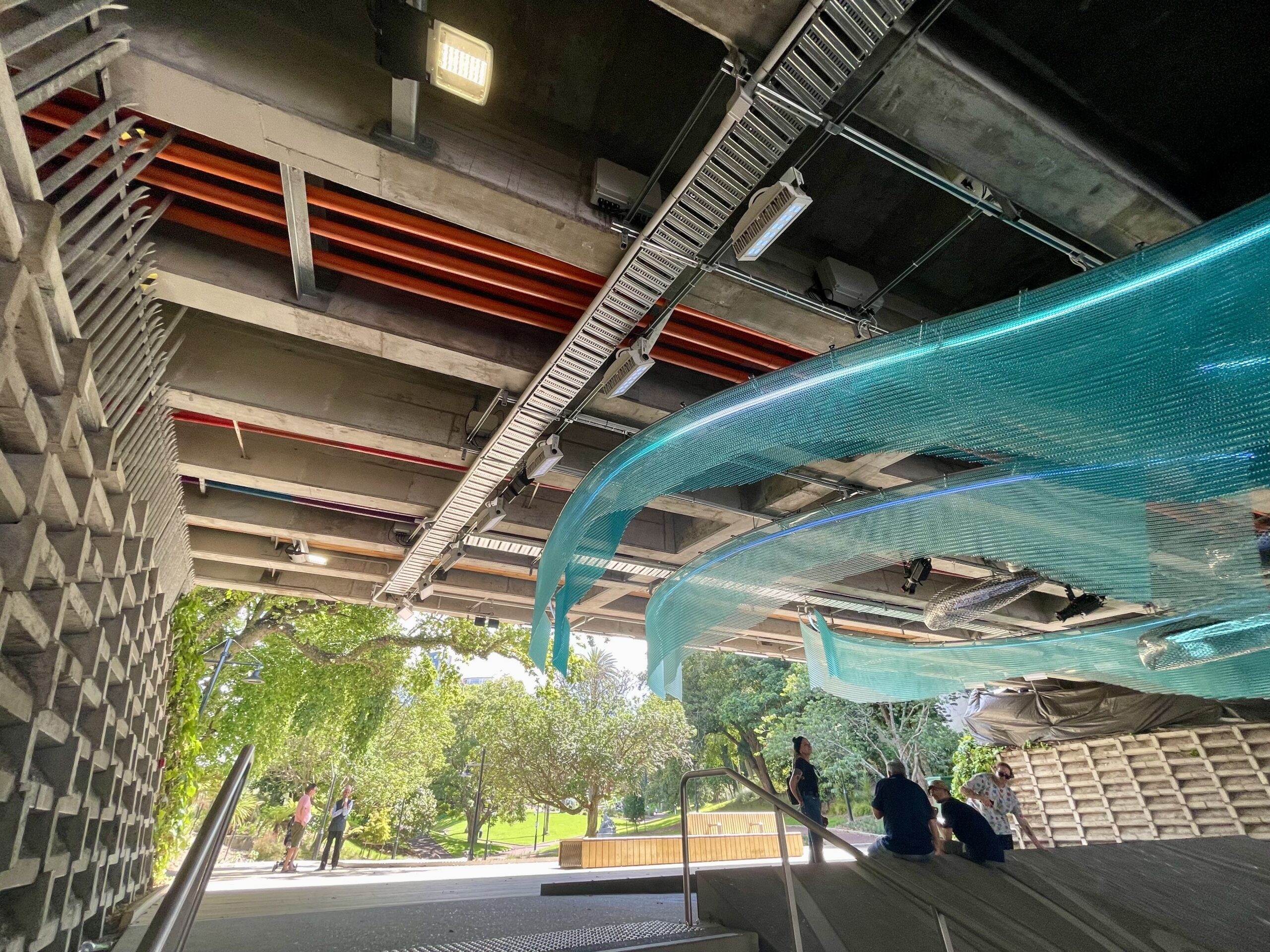
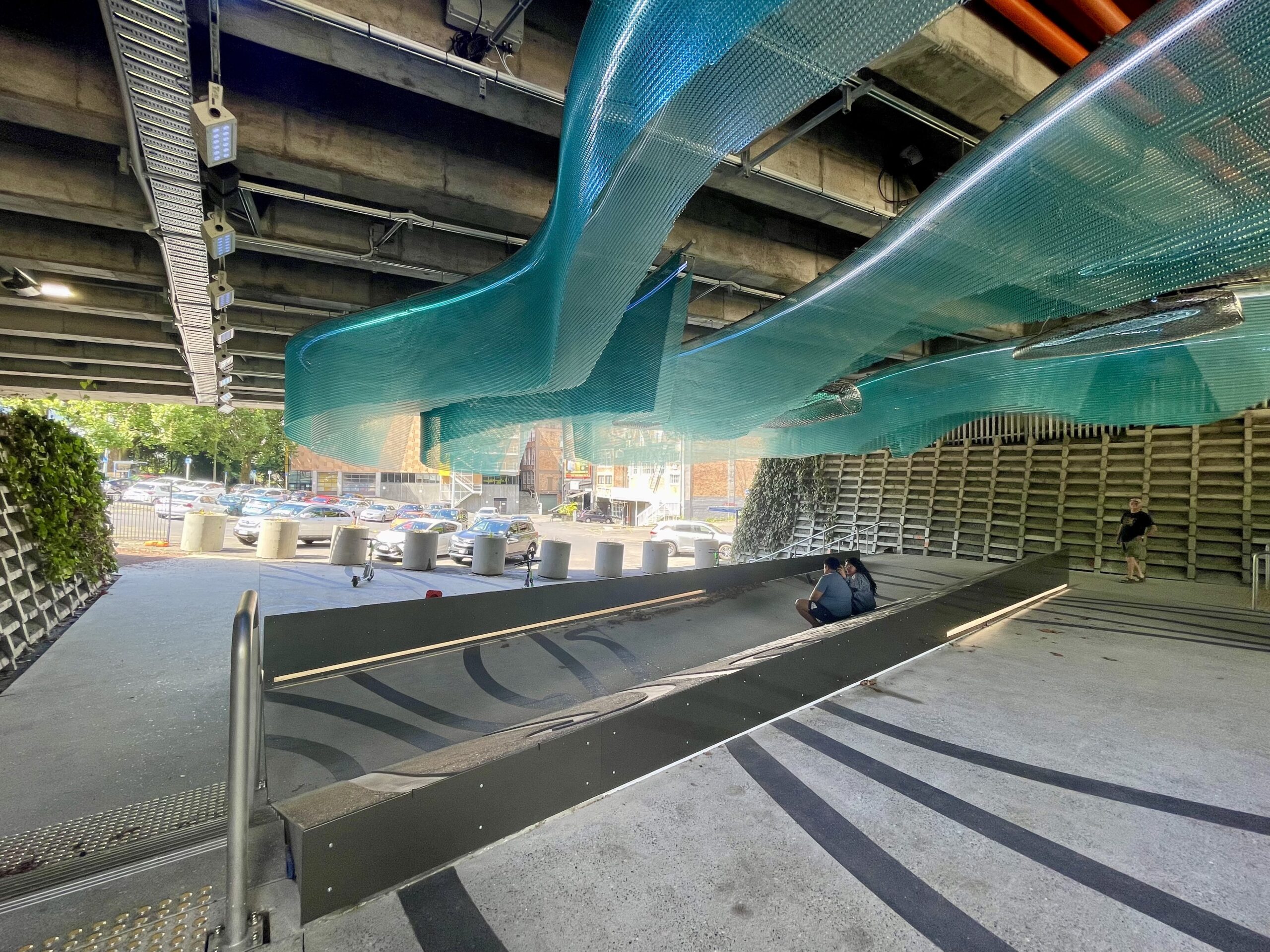
This beautiful redesign transformed a dingy underpass into an accessible work of art ,with visual and aural effects by artist Graham Tipene. It includes ramps, so it’s also a stress-free way to move from Aotea Square through Myers Park to upper Queen St, past the playground and the Kindergarten. The route is well-used by pedestrians, so do share with care.
Te Hā Noa / Victoria St – under way, due for completion by April 2025
As part of the much anticipated linear park for midtown, Auckland Transport is building a dedicated two-way west-east bike path. It swoops from Federal St, across Queen St, and back up to Albert Park. It will run along the southern side of Victoria street, completely separated from both vehicles and pedestrians.
A bonus “ungap the map” win here, thanks to Bike Auckland advocacy: an interim link will connect Federal St to the Nelson St cycleway, likely starting as soon as this July!
Karanga-a-Hape Station Neighbourhood Improvements – coming in late 2024
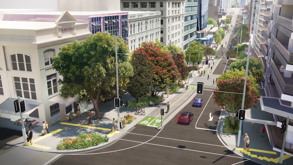
Long-awaited improvements to the Karanga-a-hape neighbourhood, designed to tie in with the opening of the new City Rail Link station. Most of this work will roll out over the next couple of years, with final touches in early 2026.
As we reported last year, the plans include a protected two-way cycleway along Canada Street, replacing the existing steep shared path towards Te Ara I Whiti, Lightpath or ‘the Pink Path’. This is great news: separation will be be safer for pedestrians, and – given the tipping hazards at that steeply cambered corner at Upper Queen St – much nicer for people on wheels, especially those with wider turning arcs like trikes, recumbent bikes, kids, and new riders.
Auckland Transport will also formalise the two-way cycleway on East St, linking Te Ara I Whiti to Karangahape Road.
As for Pitt street, last we heard, the aim is to install separated cycleways along Pitt St as far as Vincent St. We’re advocating for these to run all the way to Nelson St, as this will “ungap the map” for this section of the network. And, around what’s expected to be one of the busiest train stations on the network once the CRL opens, we all deserve better than paint on the footpath.

On the waterfront: another small “ungap the map” win…
Happy to report a recent Bike Auckland win for quality and accessibility: where Quay street meets Tangihua, there’s a ramp where the cycleway moves from the road to the footpath. This ramp is currently a sharp turn with a sideways camber, which can be dangerous for some bike types, as highlighted in our Inclusive Cycling Report 2023.
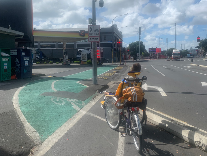
We’ve been advocating for this to be fixed for over a year, and have recently received confirmation that it will be addressed by the end of 2024. In the meantime there will be some changes to the paint markings to help highlight the potential hazard.
And a glaring gap yet to be solved!
The ageing Te Wero bridge linking the Viaduct to Wynard Quarter is currently stuck in the up position. A replacement was being discussed back in 2019, but was then deferred. This glaring gap on the map is not a great look, and means longer journeys and a great deal of stress for visitors, local residents, and businesses alike.
As one cafe owner said to the local newspaper: “We’re a cafe. We rely very much on people walking, running and cycling along the waterfront, both from the East and the West.” We couldn’t agree more that customers on foot and wheels are vital to business, and that this access should be restored as soon as practicable.
Looking Ahead…
Great North Road – Phase 2 any day now?
All eyes are on this project, a long overdue upgrade for an increasingly residential boulevard, which will improve safety and access for people cycling, walking, and riding buses along the ridge. It’s been repeatedly green-lit by the Auckland Transport Board and publicly committed to by CEO Dean Kimpton – who confirmed as recently as November 2023 that it will definitely be going ahead.
With preparatory work complete, phase two should be tendered and getting underway soon. We expect no further delaying tactics from any quarters, especially given the unprecedented support from an alliance of over 50 local schools, business and residents’ associations and community groups.
The Great North Road project expands the central city network from Karangahape Road out towards the Inner West, where the Pt Chevalier to Westmere improvements are well under way (more on this in our next roundup!), and the Waitematā Safe Routes – which will run past shops and schools in Grey Lynn – are the obvious priority for closing the gap.
This is powerful network planning, finally coming to fruition. Once all three parts are complete, an area that already has one of the highest bike-to-work and bike-to-school rates in Auckland (despite minimal infrastructure) will finally have bikeable main routes connecting their neighbourhoods with each other and into the central city. Unleash the potential!
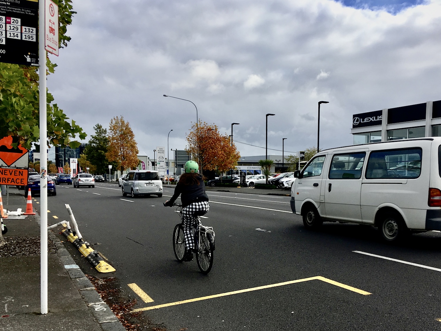
Image: Greater Auckland
Meanwhile, in Parnell – Auckland Transport consulted last October on upgrades to the intersection of Brighton Road and St Stephen’s Ave, including short sections of protected cycleway. This part of town, so close to the central city, is well overdue for safe links for cycling.
Longtime readers may recall that Auckland Transport had plans for a Parnell cycleway back in 2016. After extensive consultation and multiple community working groups (which we participated in), it was shelved. Time to bring it back?
We also have eyes on two very important downtown projects in the Waka Kotahi Auckland Network Optimisation Programme, which are set to add critical safety improvements to two key connections:
The Strand – This is a great awful dangerous hole in the network, right on the eastern edge of the City Centre. The original proposal had a gap at the railway overbridge which we pushed Waka Kotahi and Auckland Transport to solve. We’re expecting an update in July.
Wellesley Street – Stage 3 of this project will add a vital cycling link from Queen St towards the university quarter and onwards to the Domain, adding a bikeable underpass below Symonds St and tying in with the Grafton Gully cycleway. Again, we hope for updates soon.
And lastly: a word about “projects” vs “network”
Project Watch is also Network Watch. Of course each new bit of pathway – no matter where, or how small – enables more of us to get from A to B by bike. The true value is only really unlocked when each piece is part of a full network and there’s no limit to the journeys we can make by bike!
So, as we report on each small win, our eyes are always on the prize. A citywide network is key to unlocking the massive untapped potential, including those short everyday trips that are easiest to switch from driving to jumping on a bike.
The network really is this “one cool trick” that solves congestion, reduces travel costs, empowers kids, and makes Auckland a more attractive and healthy place to live. And the great news is, people get it. The most recent survey by Waka Kotahi confirms that 70% of Aucklanders support cycling in our community, second only to Wellington in our enthusiasm.
And when you bring Aucklanders together to talk about transport, they only become more enthusiastic about the bike network! A recent citizens’ assembly invited 100 Aucklanders – chosen to reflect the full range of folk in our diverse city – to discuss transport solutions.
The results were extremely affirming. Before discussion, 65% of people on this “jury of our peers” supported “a safe and connected bike path network across the Auckland region, including removing car parking spaces where required”.
After deliberation, that rose to 85%! This is amazing, considering 73% of participants said they personally biked infrequently if ever. It’s wonderful to see the growing understanding that Auckland doesn’t just look better on a bike, it works better for all of us when anyone who wants to go by bike is able to.

