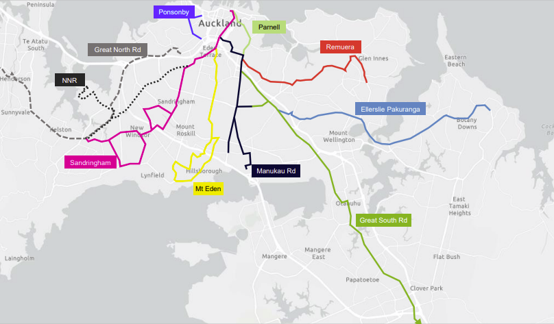
Following our recent Central City update we turn our eyes to the Isthmus. Full of people, and places they can bike to – shops, schools, public transport – this central swathe of Tāmaki Makaurau Auckland is blessed with access to the wider cycle network, and fun local paths through alleyways and green spaces.
So why do we call the isthmus the “Bike Bermuda Triangle”? Because it’s ridiculously short on safe streets and direct bike routes, despite being criss-crossed by broad historic tram avenues with heaps of room to spare.
Like every part of the city, this area enjoys huge potential for everyday cycling, and yet continues to endure preventable tragedies because of delays in making its streets safe to cycle on. Will this decade finally see real, healthy, safe transport choices for everyone? What recent progress can we celebrate? What’s the plan to ungap the map?
Settle in and read on…
Eyes on the Inner West
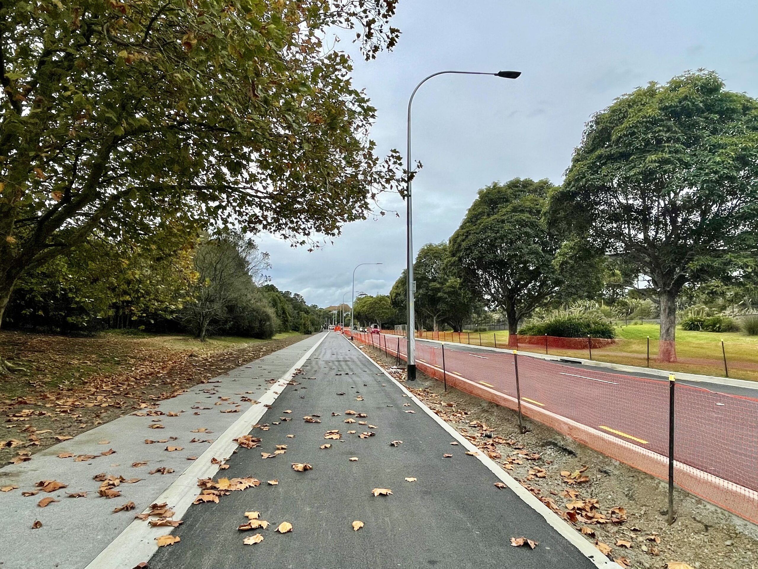
Pt Chevalier to Westmere – under way, due for completion by mid 2025
After almost a decade in the works, this multi-modal makeover is well under way. It’ll deliver much more than bike paths, taking a “dig once” opportunity to fix ageing infrastructure, add greenery, oh and rebuild an entire road from the clay layer up.
The most visible progress is in the middle part of Meola Road, recently reopened to vehicles. Which raises the question: what’s the timeframe for access to the new north-side bidirectional bike path (plus bonus footpath!) and the raised crossings that give safe access? We’ve been hearing “end of May”, and are seeking confirmation.
Work will continue over the next year on the rest of Meola and Pt Chevalier Roads, and has just begun on Garnet Road to the Westmere shops. We trust Auckland Transport has a plan to plug the remaining “Grey Lynn gap” (aka Waitematā Safe Routes) through to Great North Road, thus completing the Inner West network as called for by an unprecedented community alliance!
Also incoming: a Bike Hub in Grey Lynn Park, the newest in a network of bike hubs across the region.
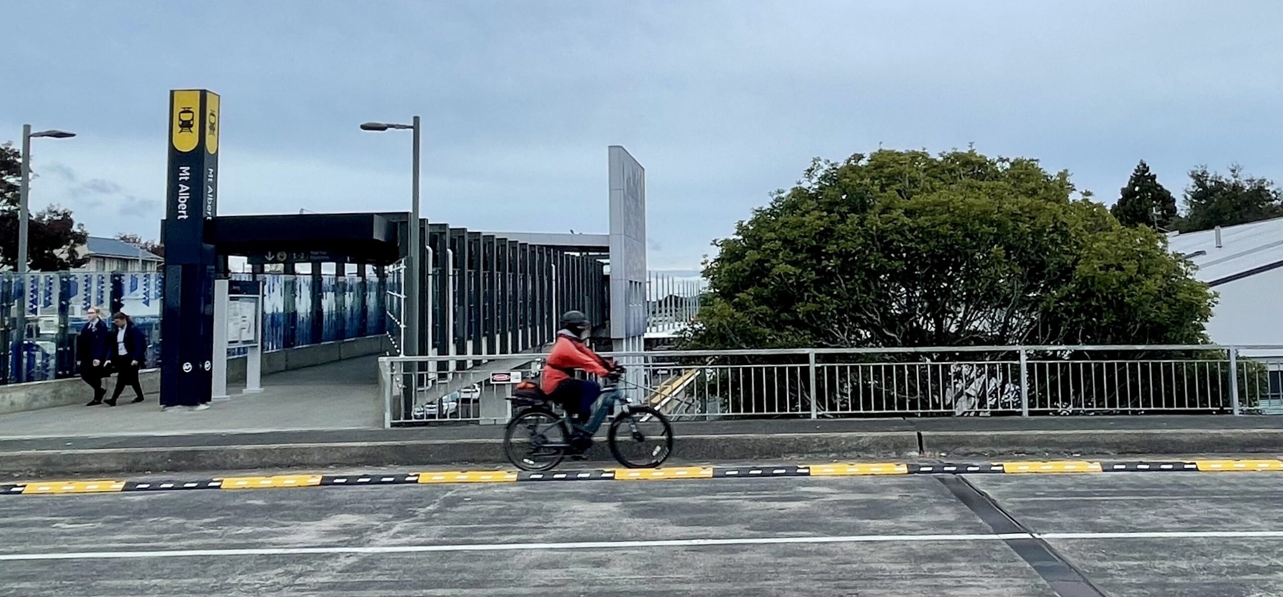
Carrington Road – Construction scheduled for 2025 – 2026
A major upgrade is planned for Carrington Road, which includes protected cycleways from Pt Chevalier to Mt Albert town centre – and potentially a new treatment for the busy Northwestern crossing at Sutherland Road. The initial consultation in late 2023 showed a strong preference for protected cycleways on each side of the road (rather than a two-way cycleway on one side of the road), and Auckland Transport is currently working on creating a preferred option.
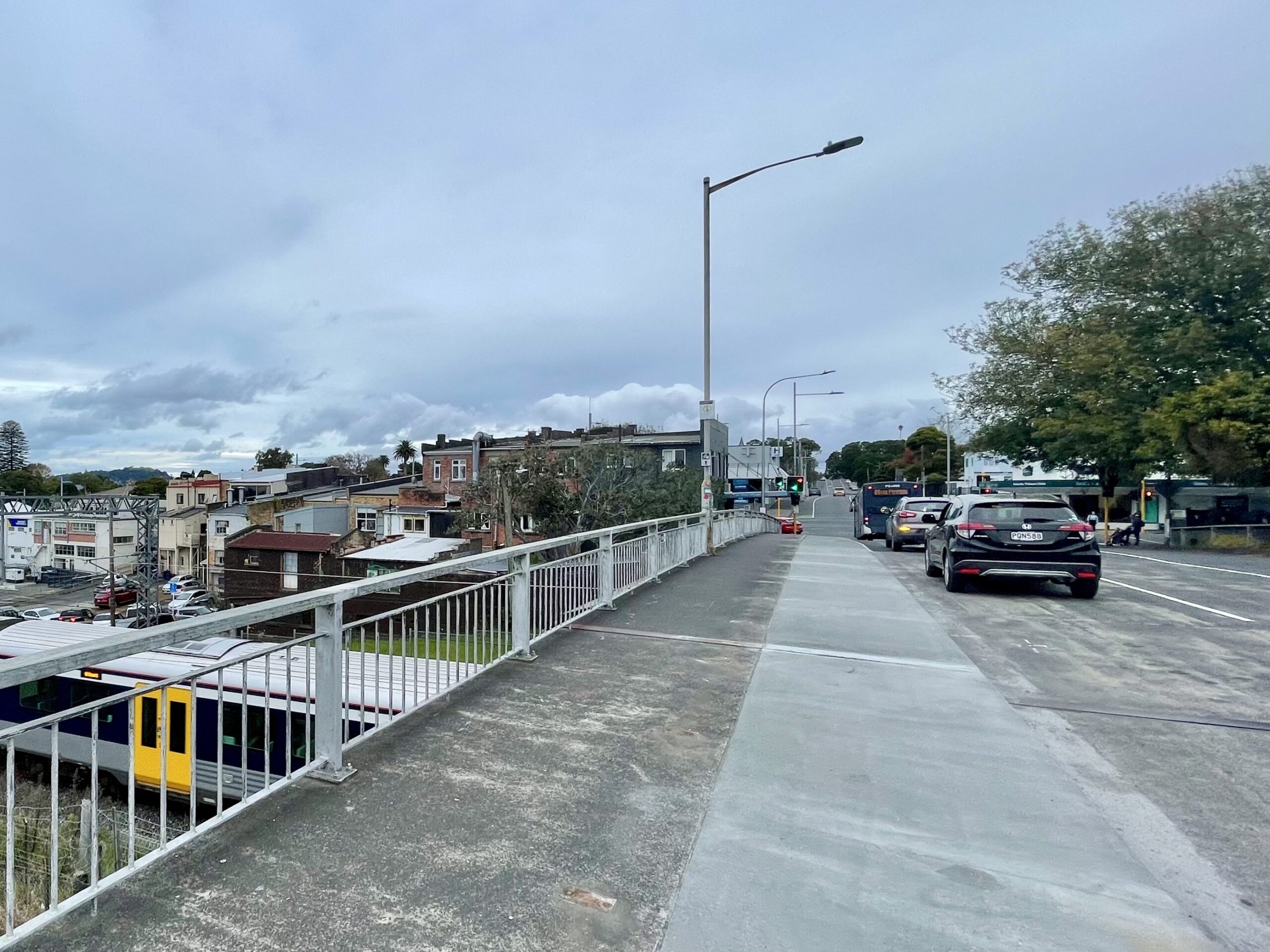
At the Ōwairaka Mt Albert end, ahead of closing the Lloyd Ave level rail crossing, Auckland Transport is extending the eastern footpath on the over bridge to create safer walking and cycling journeys. (Note: it’s not clear from available diagrams but this looks to be a shared path). Bonus: they’re adding some protection to the existing on-road painted bike lane on the other side of the road too!
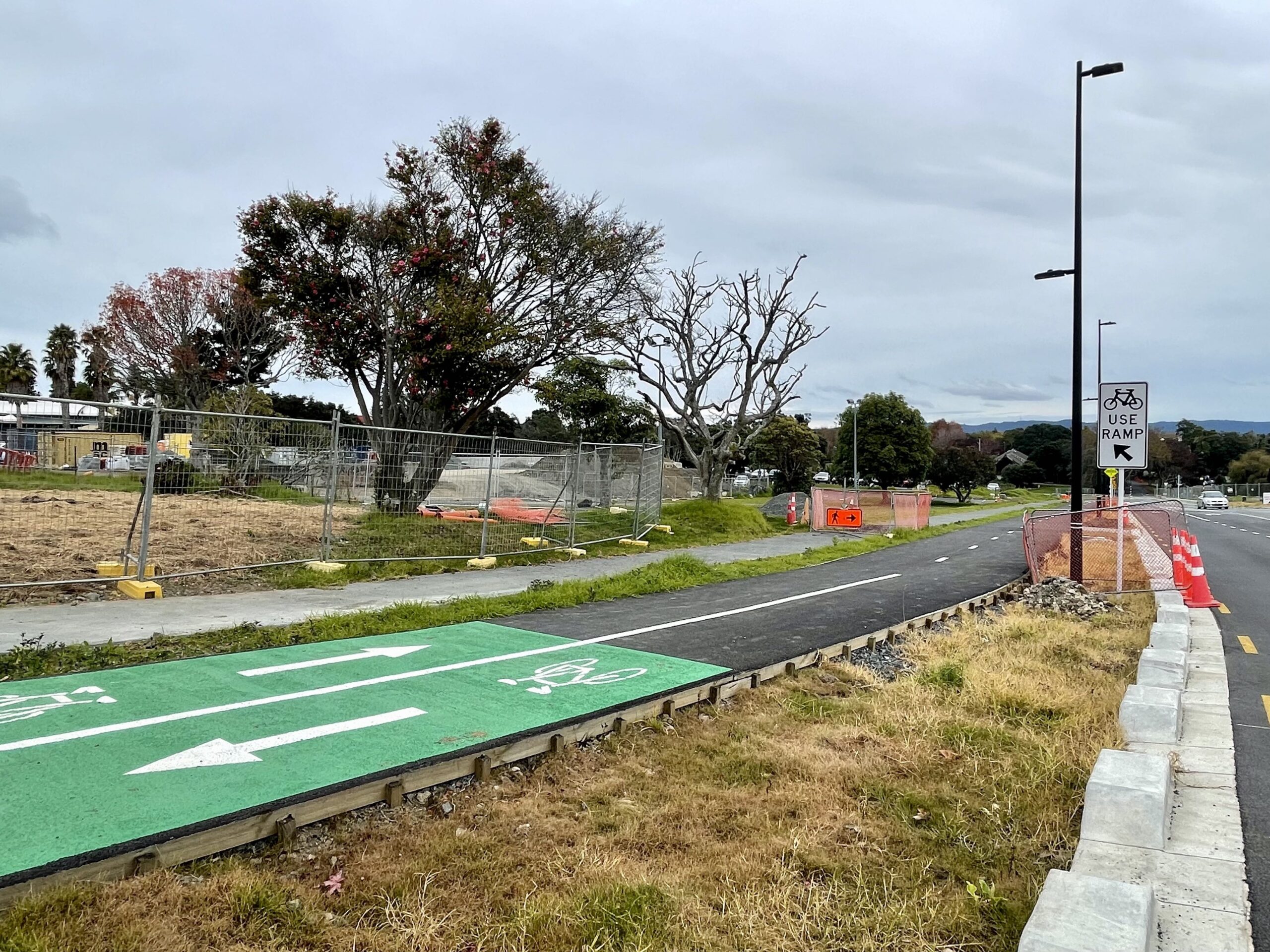
The Carrington (Unitec) Development – in progress
Connecting into Carrington Road, cycleways are currently taking shape on the former Unitec site, supporting the planned housing development. A section on Farm Rd is already open, and offers a handy link to the Waterview Path. We’re curious about the staying power of the path’s timber edging.
City Fringe
Waitematā greenways – completed mid 2022
Kudos to Waitematā Local Board for two handy greenways:
- Cox’s Bay Reserve to Wharf Road (a short hop to Jervois Rd) – completed May 2022
- Motions Road to Meola Road, linking MOTAT2 to the Zoo – completed August 2022


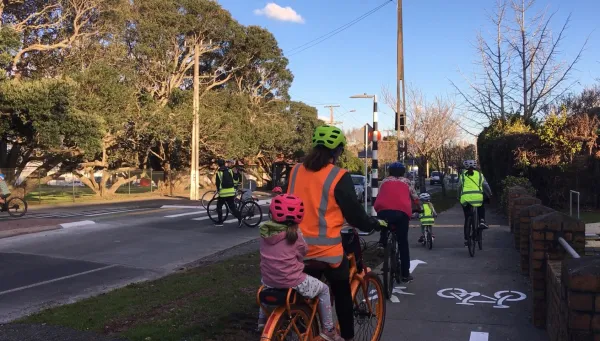
Want more local links? You have until 31 May to weigh in on Waitematā Local Board’s Local Active Modes Plan (LAMP), which covers Herne Bay, Saint Mary’s Bay, Three Lamps, Westmere, Ponsonby, Freeman’s Bay, West Lynn, Grey Lynn and Arch Hill. Shine some light on connections in this area!
Auckland Domain paths – a work in progress?
The accessibility improvement plan for Auckland Domain includes paths and traffic-free streets. It’s moving at glacial pace: see Item 14 on the agenda for this coming Monday, 20 May. While not cycling-specific, the proposed changes will make the Domain so much nicer for people on wheels and on feet.
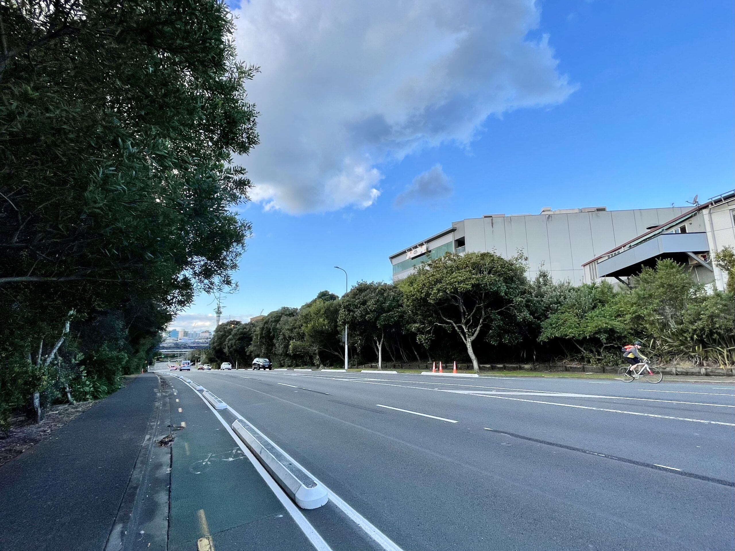
Ian McKinnon Drive – completed August 2022
Along the flyover section of Ian McKinnon Drive Auckland Transport has added concrete tim-tams on both sides of the road, linking the Northwestern to Dominion Road. We love practical pop-up protection!
Looking East
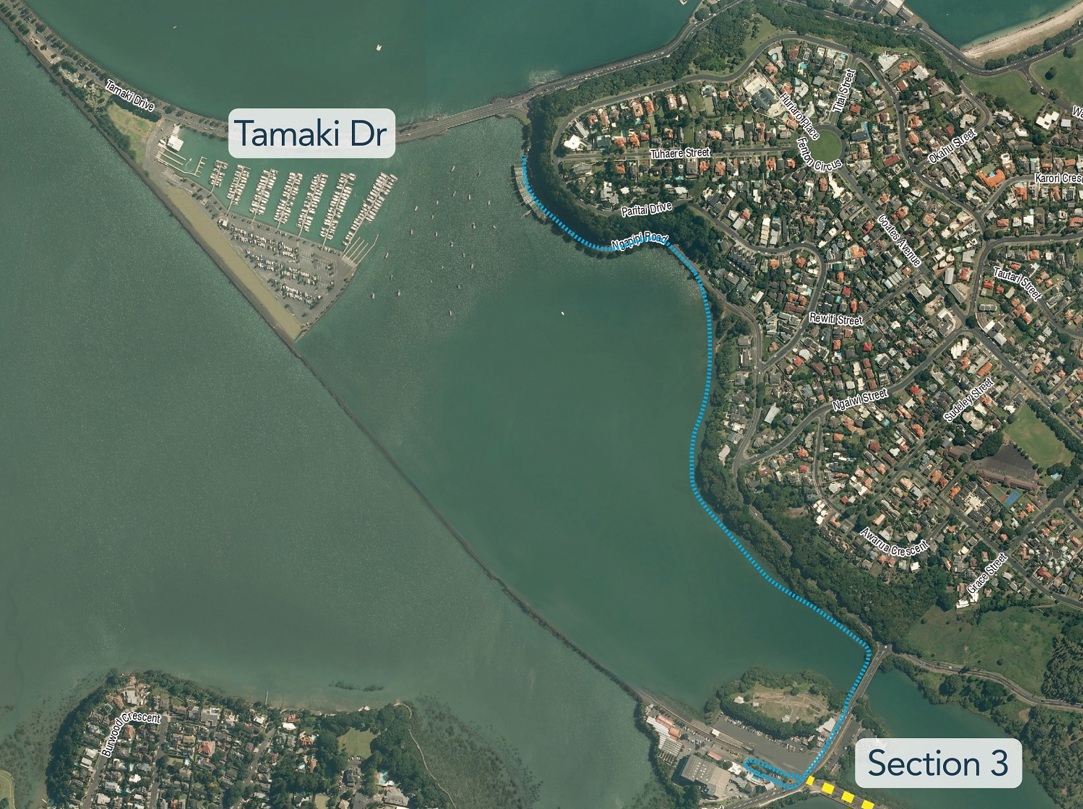
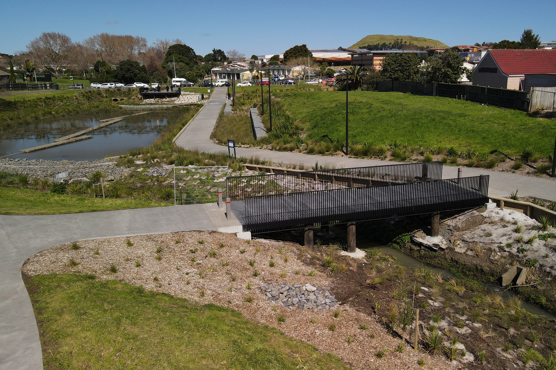
Ngāpipi Bridge – completed April 2024
At last! This upgrade completes the continuous, safe and separated waterfront paths for walking and cycling, all the way from the city to Ngāpipi Road. Bike Auckland worked long and hard for this one – remember when we persuaded Auckland Transport to do better?

A challenge for anyone thinking of running for Mayor: now keep going along Tāmaki Drive! Give Auckland the world-class bikeable and walkable waterfront promenade it’s always deserved, by delivering the full vision of the Tāmaki Drive masterplan.
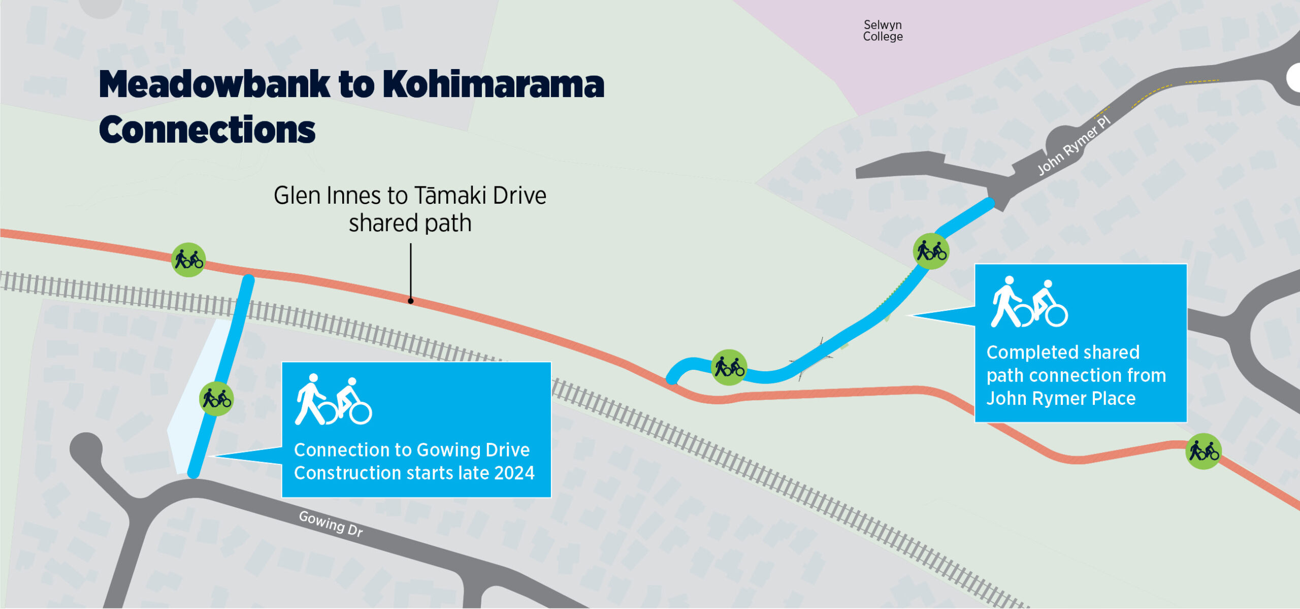
Te Ara ki Uta ki Tai / Glen Innes to Tāmaki Drive Section 4 – out for tender?
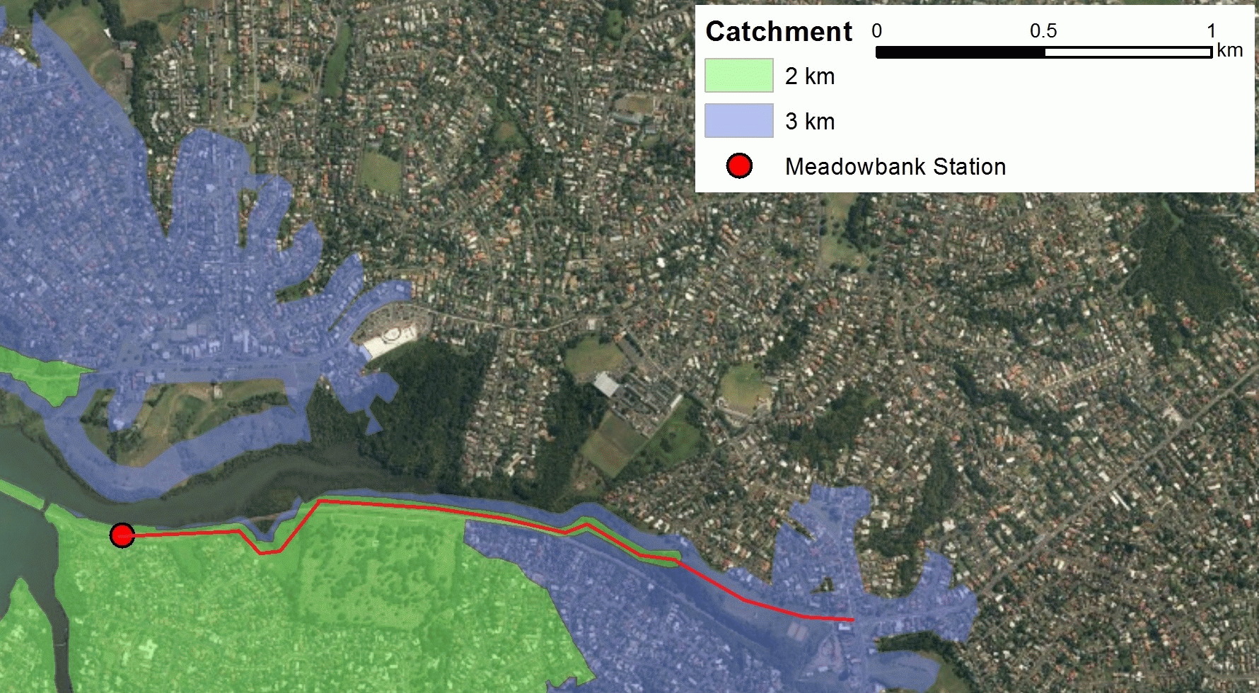
The last piece of the puzzle for Te Ara Ki Uta ki Tai (Glen Innes to Tāmaki, or ‘Eastern Path’) is the section that connects Ōrakei Station to Tāmaki Drive. This will complete Tāmaki Makaurau Auckland’s “east wing” of long-distance cycleways – and, combined with the Northwestern shared pathway, will effectively enable 30km of (almost entirely) traffic-free travel all the way from Glen Innes to Westgate. Our very own east-west link!

In the meantime, as an interim measure, a safer connection from Ōrākei to Tāmaki Drive has been provided via a widened footpath and protection for the uphill along Ngāpipi Drive. It’s not super intuitive to use so here are some tips:
– When going towards Tāmaki Drive (uphill) use the protected (mostly) on-road cycleway provided.
– When going towards Ōrākei (downhill) you can choose between
(a) sharing the road with the cars and trucks, or
(b) riding on the widened western-side footpath. On the footpath, you should keep to the right – please share with care and watch out for cars exiting driveways.
What about that legendary Gowing Drive connection? It’s highly likely that Auckland Transport is struggling to find the budget for it. The Gowing Drive underpass has strong support from locals as a way to “ungap the map” and expand the catchment. It would be a vital connection for children trying to walk or cycle to school in an area whose residential streets are frequented by heavy traffic and large trucks.

Links to Glen Innes Cycleways
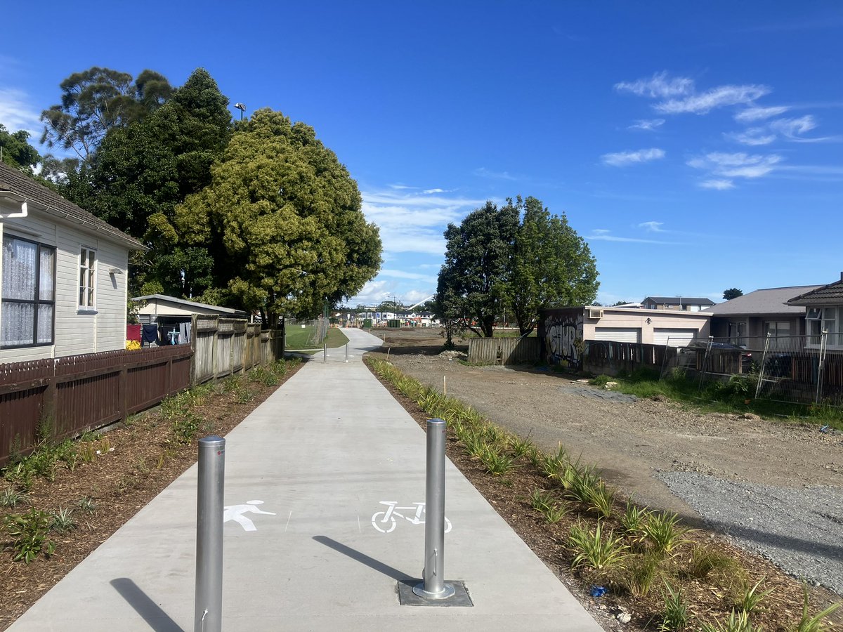
Like the Inner West routes, the Glen Innes network has been on the horizon for nearly a decade. This suite of protected bike lanes creates local links to the town centre and train station, as well as to the surrounding existing – and planned – cycleways. Work is continuing through the town centre, on Taniwha St, Apirana Ave, and a stretch of Point England Road.
Keep track of construction progress here.
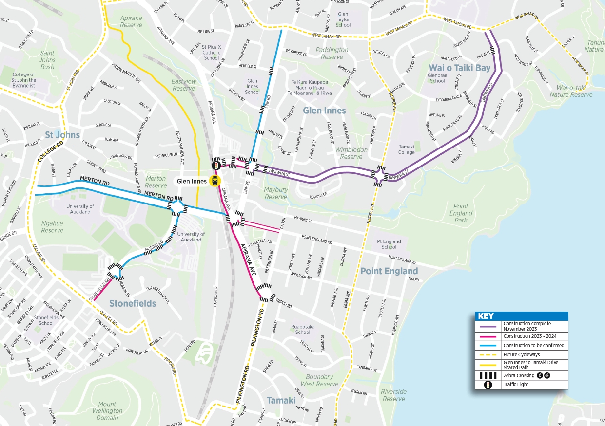
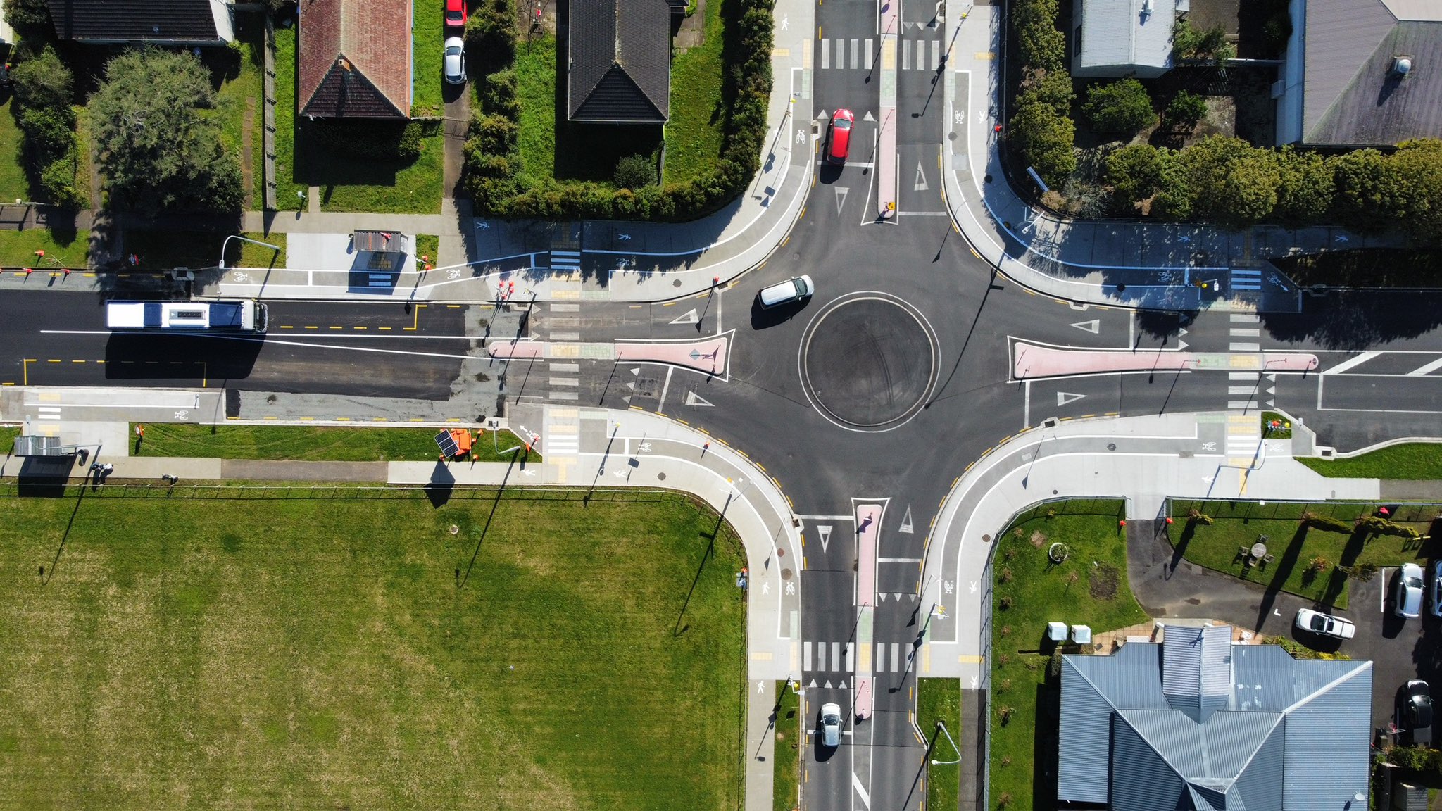
Taniwha St (Line Road to West Tāmaki Road) – completed November 2023
Already up and running: the robustly protected bike lanes on Taniwha St, and the real showstopper, a retro-fitted Dutch-style roundabout at the intersection with Elstree Ave. Along its length, raised crossings give people safe access to the schools, bus stops, and houses.


Still to come is the final section of Taniwha St (Line Rd to Apirana Ave), connecting into the town centre. Construction is scheduled to begin in July 2024.
Apirana Avenue – under way, due for completion mid 2024
The Glen Innes Train Station now has more space for people; the footpath in front of it has been widened from Taniwha St to Merton Avenue! New raised pedestrian crossings are in progress to give safe access to the train station and bus stops. A protected two-way cycleway is incoming for this same stretch in front of the train station; only asphalt, concrete protection, and paint markings left to go.
Glen Innes greenways
Auckland Council has added better lighting and paths for walking and cycling to Taniwha reserve (completed August 2022) and a similar glow-up is coming for Eastview Reserve. These two parks for people will form a seamless route to the Glen Innes town centre, and are part of a green ribbon of connection along Omaru Creek to Point England.
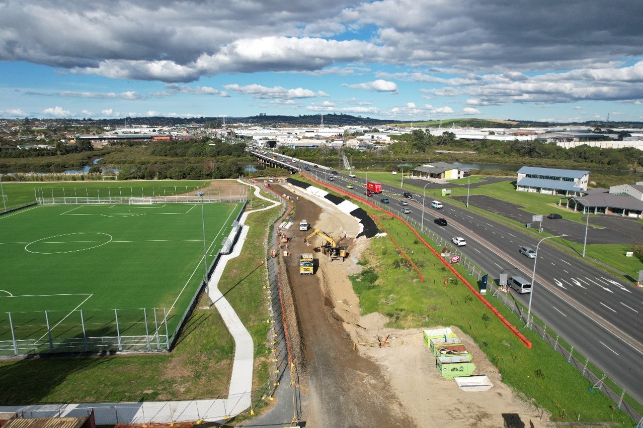
Pakūranga to Botany cycleway – under way
Construction is under way, continuing the Eastern Busway (and cycleway!) from Pakūranga towards Botany. This is expanding on the section from Panmure to Pakūranga which opened in late 2021. You may have spotted the recent consternation over funding; we understand the final bit (Stage 4 from Ti Rakau Dr to Botany Station), has been dropped from the Long Term Plan by Auckland Council.
A new path for Panmure – construction scheduled for 2025 – 2026
A collaborative project under the wing of Eke Panuku will make it safer and easier to walk and bike between Maungarei (Mount Wellington) and the Panmure town centre. From Maungarei, the path will run along Mountain Road, then Potaka Lane to Queens Road in Panmure. Ultimately, it’ll form part of the Tāmaki Loop (see the map here).
Elsewhere around the Isthmus
Hendry Ave – completed mid 2023
Speed-calming treatments are a very welcome improvement for this very steep street, which is a crucial connection from the Southwestern Cycleway towards Onehunga – and via the new Nga hau Māngere to Māngere Bridge and beyond!

Puketāpapa greenways continue to grow
Shout-out to Puketāpapa, Mount Roskill, whose reputation as one of the most bike-forward parts of town comes from cleverly leveraging blue-and-green space, Kāinga Ora regenerations and existing alleyways to build a local network. Here are two great recent examples, designed to go along with thousands of new homes in the area:
- Wide shared paths along a daylighted stretch of Te Auaunga / Oakley Creek in Molley Green Reserve, Waikōwhai –plus playgrounds, a food forest, and more.
- A shared path through Murray Halberg Park in Ōwairaka, Mount Albert. We love to see bike access as a built-in part of holistic neighbourhood design!
The Heart of the Bike Bermuda Triangle
Concerning disappearances…
In early 2020, we asked about progress on Waka Kotahi NZTA’s plan to “investigate” a SH1 cycling route from Newmarket to Ellerslie. Not long after, they quietly abandoned the work on the grounds that Auckland Transport was investing in Great South Road via its Connected Communities programme.
That Connected Communities work also quietly folded in 2023 with, as a recent OIA confirms, no tangible safety outcomes on Great South Road (or Broadway, Manukau Road, Mt Eden Road…). This is hugely disappointing, given the years of work and $30m in investment.
…and miraculous reappearances?
However! We take hope from the fact that the plans for the New North Road and Symonds Upgrade in particular are well-advanced, with the Albert-Eden Local Board supporting the full project. We continue to advocate for this one to proceed via a different programme of funding, and trust that this is within reach.
And, as soon as we Liberate the Lane, the isthmus and the North Shore will be one continuously connected playing field!