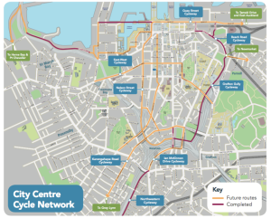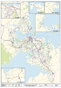
It’s not every day that you see cycle advocates happy at seeing bike routes removed from a planning map – but in this case, we are.
Because after years of advocacy, Auckland Transport has now removed the bus lanes from the ‘existing cycle facilities’ map of the official Auckland Cycle Network. In other words, the maps no longer claim that roads like Remuera Rd or Symonds Street are finished parts of the cycle network.
Reality wins, and so does better forward planning from now on.
This deceptively simple step took years of advocacy from ourselves, and from some good local politicians like Pippa Coom, Deputy Chair of the Waitemata Local Board. It required Auckland Transport to accept that the often haphazard bus lanes, despite some Legacy Councils stating otherwise, really didn’t match people’s expectations of what a “cycle facility” is.
So technically, the “existing” cycle network has suddenly become a lot smaller, which was probably the reason the change took so long. Nobody likes to ‘go backwards’. But we think it’s for the best. It means that AT is raising their standards on cycling – congratulations, and heartfelt thanks!
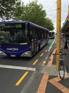 And yes, the map still includes some errors and route sections that shouldn’t really be called ‘existing’ – but right now, we don’t feel too grumpy about this, because AT has accepted that this, for example, is great (for a city), but is not a completed cycleway: ->
.
.
.
.
Future cycleways
If this talk has awakened your interest about which routes AT is currently planning to upgrade over the next years, have a look:
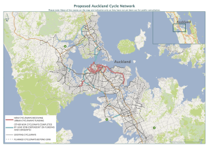 For an overview, here’s Auckland Transport’s current 3-year building plan for the Urban Cycleways Fund routes (click to enlarge the map; more info on this page).
.
.
.
.
.
And maybe this is also a good time to remind you that we have a ton of links to useful maps now, and some great starter routes for riding with kids or riding in your neighbourhood (see top menu Maps & Rides and start clicking around). Happy route planning, and joyous riding!


