Ever wanted to ride from the Waitemata harbour to the Manukau harbour on a protected path surrounded by wildlife and waterways, in less than an hour? “Impossible!” you say, rolling your eyes, “and definitely, DEFINITELY, not in car-obsessed Auckland.” Well, just wait. Because Te Whau Pathway – along with Skypath and Seapath – is going to be one of Auckland’s key destination rides.
In the guest post below, Bike Te Atatu’s Melanie Dixon, Simone Bähr, and Carol Green explain why we should all support the resource consent for this great project – and how to have your say.
QUICK FEEDBACK GUIDE
Submissions on the Te Whau Pathway resource consent are open until 12 December, and you can add your voice in support here. Below are our quick suggestions for feedback:
Firstly, tick the box to say you “support the application in whole or in part”, then there are three questions…
Q1: Specify the aspects of the application you are submitting on.
Suggested response: “Boardwalk and path construction”
Q2: What are the reasons for your submission?
Answering this one is optional – but it’s your chance to say why the project is important to you, and what kind of journeys it will help you make. For example, will you use it to get to work? Kids to get to school?
Q3: What decisions and amendments would you like the council to make?
Suggested response: “Please approve the application in full.”
Where is Te Whau Pathway?
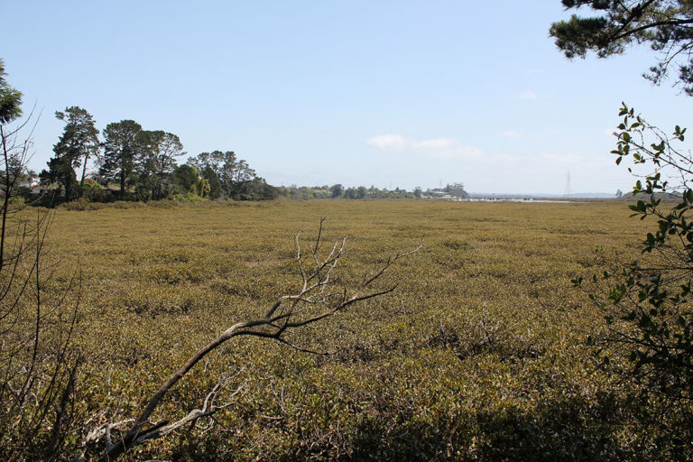
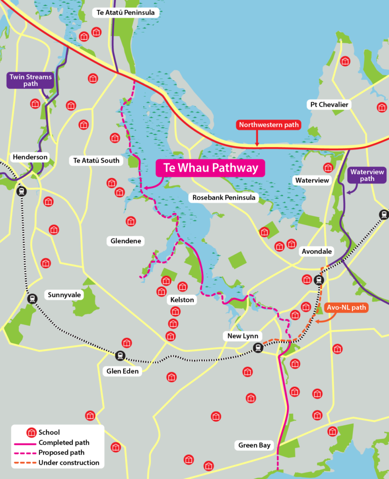
In West Auckland, from the Northwestern Cycleway at Te Atatu, to Green Bay on the Manukau Harbour. The path will run along the Whau River and unlock cycling opportunities in neighbourhoods such as Glendene, Kelston, Avondale and New Lynn which back onto the Whau River. Once you start looking at the burbs that back onto these suburbs, you can see that the effect of Te Whau Pathway will be greatly magnified.
When will it be built?
It’s already under way! Well, in bits. Construction started in 2015, and so far 2.9km of the pathway has been completed. The remaining 10km – comprising 7km of boardwalk and 3km of shared path – is yet to be built.
So let’s do this!
First it needs Resource Consent. Secondly, it needs a fairy godmother with deep pockets. Luckily, the Resource Consent is already underway. And public submissions close 5pm, 12th December.
If you like, you can pore over the hundreds of pages of detailed specs and maps about the pathway. Simpler still, you can just read this blog post and make a quick submission.
Every submission is important regardless of how much or how little you say. The more the Council receives, the more our representatives in the council will know that we think this is an important project, and one that deserves funding.
Key facts about Te Whau Pathway
- When finished it will connect 33 reserves, esplanade reserves, sports parks and roads.
- 20 schools are within 2km of the proposed path.
- The proposal includes seating, art, interpretation and extensive ecological restoration (such as weed control and replanting).
Who is behind the pathway?
The project has been driven by a not-for-profit trust; the Whau Coastal Walkway Environmental Trust. It’s a collaborative project between the Trust, Auckland Council, Auckland Transport, the Whau Local Board and Henderson-Massey Local Board, Te Kawerau a Maki and Ngati Whatua Orakei. The resource consent is being applied for by Auckland Council’s Community Facilities department.
How much will the pathway cost?
The latest estimated cost to build Te Whau Pathway is $66 million – which may be one reason many think it shouldn’t be a priority. But here’s why we think it’s worth every cent.
Why is Te Whau Pathway worth supporting?
Reason 1: Congestion-free travel – and safer, more convenient connections to the city centre
The mid-century West Auckland suburbs that back onto the Whau River are traditionally car-centric. Think Detroit! Not quite. But people living in these areas are 20% less likely to use public transport, bike or walk to get around than the rest of Auckland. It’s going to take bold changes – like Te Whau Pathway – to turn this around.
With the recently announced plan for a “pop-up” busway along the North Western Motorway, Te Whau Pathway will provide high quality transport links within an easy 5km bike ride for over 30,000 West Aucklanders, namely either the Te Atatu interchange for those in Te Atatu South and Glendene, or the New Lynn transit station for those in Kelston and New Lynn (via the under construction New Lynn to Avondale shared path).
Of course, many Westies will happily ride much further than 5km: we’re seeing a continual rise in numbers on the Northwestern Cycleway, and e-bikes are tripling journey distances for many riders (and empowering more women to ride).
Te Whau Pathway will link to the Northwestern Cycleway via the Waterview Path and the under-construction New Lynn to Avondale Shared Path, enabling heaps of people to make safe and enjoyable off-road trips across the city.
This is an incredibly strategic link in the Auckland bike network, part of a “super triangle” centred around the Avondale Peninsula. In our view, this is the reason why NTZA need to seriously consider stepping up to be a major funder of this project.
Reason 2: Safer, more pleasant journeys between local neighbourhoods
As well as connecting people to the wider cycleway network for commuter journeys, this pathway will create attractive local connections to schools, town centres, sports grounds and local bus stops.
This is especially important for the area, as communities along the route have become disconnected from the river and from each other. In part this is due to geography – the Whau River has tributaries that the pathway will bridge. But it’s also due to the lack of public land along the water’s edge, and poor street networks.
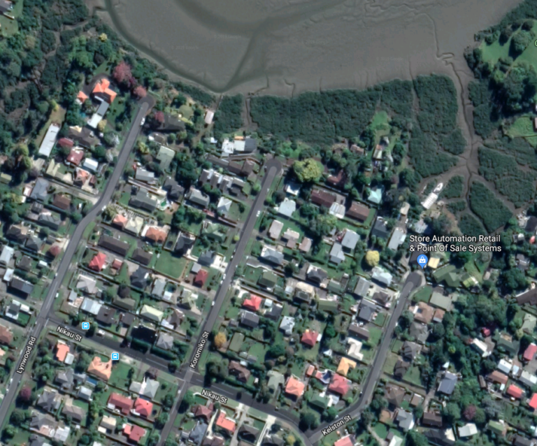
The pathway will let people move around the neighbourhood safely, without the need to drive. This is particularly important for residents who may have limited access to other transport choices, e.g. those too young to drive a car or with limited access to a private vehicle. Overwhelmingly, too, the areas within 2km of the pathway have a lower median income than other areas of Auckland, meaning many will be struggling to afford a car.
Imagine if Auckland Transport’s safer speeds programme calmed speeds on the streets between the Whau River and the main arterials of Te Atatu Road and Great North Road? A quick and efficient way to expand infrastructure, so locals wouldn’t have to own a car to enjoy quality of life. And children could travel more independently.

Reason 3: Reconnecting people to the river and restoring its mana
Angela Thomson’s 2017 history of the Whau River contains stark details of how it was treated by European settlers. For example, in the 1860s, polluting industries such as tanneries specifically moved out west to “discharge noxious wastes, unhampered by legal proscription or public pressure”. In the 1920s, local residents complained they had to shut their windows, such was terrible smell coming from the Whau. You can see why development in the 1950s and 1960s “turned its back” on the Whau River.
Says Mel: “I grew up near the Whau in Te Atatu South in the 1980s and I have never swum in the Whau, although living near it sparked my life-long admiration of mangroves. Swimming and/or fishing in the Whau River was more common in my mum’s day – she used to swim near the current Te Atatu Boat club location. I would love to see the next generation of Whau dwellers to be reconnected to their river and to have stronger links with nature.”
We think Aucklanders deserve a natural connection and better access to the river, like those in the fifties and sixties enjoyed. Moreover, this project will reconnect people with the waterway and thereby facilitate its restoration.
Forward-thinking cities from Wellington to Singapore are ensuring urban dwellers can access natural spaces within a 10-minute walk or cycle (check out the Singapore Index on Cities’ Biodiversity). By contrast, these car-centric West Auckland neighbourhoods have few green spaces within easy reach, and suburbs like Kelston and Glendene compare poorly with nearby suburbs that enjoy access to coastal walks (Te Atatu Peninsula) or streamside strolls (Te Atatu South, west of the main ridge line).
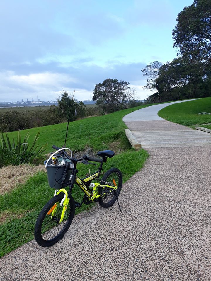
The Te Whau Pathway design maximises opportunities to experience the Whau River, and will improve access to the river for small boats and kayaks. The project involves extensive planting and weed control along the margins of the Whau – partly this is needed in order to get a consent to build the path, but mostly it’s the ethos of the numerous dedicated people and groups behind the project.
When Te Whau pathway is completed, it will attract visitors from other parts of Auckland. Imagine catching the train to New Lynn and to ride a ~21km entirely off-road circuit.

Let’s change how we see the Whau, and support this pathway to bring people back to the river. In Angela Thomson’s words, our river is:
“an often neglected taonga that has not lost its beauty but it has been veiled behind years of disregard, pollution and misuse. It is time now for that view to be lifted and for the Whau River to be celebrated as a picturesque place of choice to walk, row, cycle, swim, fish and meet new friends and neighbours – all the way from Green Bay to Te Atatu Peninsula!”
— Melanie Dixon, Simone Bähr, and Carol Green from Bike Te Atatu
And here’s the quick feedback guide again:
Click the “support the application” box, then answer the three quick questions:
Q1: say “Boardwalk and path construction”
Q2: say why the project matters to you (optional but a good thing to do!)
Q3: say “Please approve the application in full.”


