What happened to… the Waterview Cycleway?

Oct 13, 2014
What happened to… the Waterview Cycleway?

Max

2 min read
Wat 01
The finalised route – not shown: connecting path already being built as part of the motorway project in the south, and a future cycleway along the rail line to the southwest to Avondale / New Lynn.

A month ago, at the last Waterview Project CLG (that’s “Community Liaison Group” for those who have NOT spent about 20 evenings over the last years attending these…), the project leader from Auckland Transport provided an overview of the current state of the project. You can view a short presentation he gave here.

The bad news is that it may take up to 2017 for the cycleway to be open. This is 6 years since the funding was approved. Not fast, whatever way you look at it. AT are promising that they will be running some processes in parallel, hoping to speed up the post-consent preparations and maybe have it open by 2016. The Well Connected Alliance, who are already building the tunnel, is understood to take on the job of building it, so they are already on-site and should be able to get right onto it. Knock on wood.

The good news is that the design is pretty advanced for the remaining approvals that are needed, and we understand there has finally been agreement reached on the location of the “Alford Bridge” (from Waterview over to the Unitec side), which had created some difficulties intially to fit it in with the potential development plans for the Unitec area.

Some land purchases in the Phyllis Reserve area and negotiations with affected neighbours at Soljak Bridge are proceeding, with mitigation and compensation (where required).
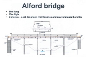
Wat 02
Alford Bridge – this bridge will be located very high over the creek, helping make it attractive as a student walk/cycle route to Unitec even at night, compared to the current route which dips deep into the unlit gully on narrow paths and bridges).
Wat 03
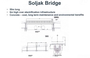
Soljak Bridge over the rail line – the bridge had to be very high due to the rail electrification, and very wide to allow for future extra rail tracks. The two bridges consume most of the $8 million set aside by the Board of Inquiry for the path.
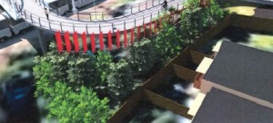
Soljak Bridge seen from above the Solja Place' resident's houses. The red panels (which likely won't be red in the final design) are intended to screen their backyards from nosy passers-by on the bridge...
Soljak Bridge seen from above the locals resident’s houses. The red panels (which likely won’t be red in the final design) are intended to screen their backyards from nosy passers-by on the bridge…

Join us

Bike Auckland is the non-profit organisation working to improve things for people on bikes. We’re a people-powered movement for a better region. We speak up for you – and the more of us there are, the stronger our voice!

Suggest a new ride